Thursday

Day #69 August 26 Sisk-a-dee-agie


We left Slate Creek after coffee and headed south generally along the course of the Green River and entered the Seedskadee National Wildlife Refuge, US Fish and Wildlife Service. One of those out of the way beautiful spots. Virtually no traffic. A few locals. We drive a short twenty-mile loop. Lots of antelope, prairie dogs, rabbits. Seedskadee is a misspelt version of the Shoshone word “Sisk-a-dee-agie” meaning “the river of the prairie hen” now known as the greater sage grouse. The Shoshone were here for at least seven hundred years before whites came and changed the name of the river to the Green.
Before the Fontenelle Dam was built the Green River, or the Sisk-a-dee-agie which I believe is a more beautiful and descriptive name, the river meandered its way gracefully across a relatively flat broad plain. But in spring it spilled its prodigious snow melt flood waters onto that plain, forming oxbows and braded channels that laid the groundwork for development of marsh wetlands.  The wetlands grew cottonwood and willow groves that supported rich populations of mammals, birds, fish, reptiles and amphibians. Once the dam was built, the flood waters were stored behind it and used to provide irrigation to higher, drier lands.  Flow below the dam was controlled and greatly diminished in the spring. Marshes dried up so the robust and diverse flora and fauna decreased substantially.

Congress established the Seedskadee Refuge in 1965 to offset the loss of wildlife habitat, that is, to engineer on the ground measures to mitigate the losses, not an easy task, especially with the usual lack of resources available for such efforts. But dedicated refuge managers, volunteers, scientists and others work diligently generally with limited resources to progress. The ecological costs of infrastructure projects like dams are rarely figured into the overall accounting and the engineered solutions, which are admirable, rarely actually replace what nature wrought in the first place.
We stopped at Lombard Ferry where enterprising frontiersmen charged immigrants exorbitant prices to ferry their wagons and possessions across the river to facilitate their remarkable westward journey towards a new life in hot and dry regions in Oregon and California, where, they had been convinced by charlatans, that if they would just cultivate the lands the rains would come. In those regions where rain fall generally averages less that ten inched a year, they were told that if they would just buck up, put their noses to the grindstone and turn over the soil, it would miraculously start raining.  

After Seedskadee we headed into the town of Green River, WY, where on May 24th 1869 John Wesley Powell set out in four wooden boats with his brother Walter and eight other colorful characters to explore the Sisk-a-dee-agie and areas beyond that no white man had even seen.  This was only eighty years before I was born. Not that long ago.

They went through Flaming Gorge that Powell so named, a real gorge then. On through Red Canyon and then the Canyon of Lodore, picking up speed and volume, becoming a maelstrom at times. On through Desolation Canyon, Gray Canyon, Labyrinth Canyon and Stillwater Canyon. Then Glen Canyon, Marble Canyon, Cataract Canyon and more. The Colorado River. After three months and six days they reached the confluence of the Colorado with the Virgin River with many stories to tell.

With provisions from Safeway in Green River, much easier than John Wesley Powell’s provisioning I bet, we headed into Flaming Gorge National Recreation Area, US Forest Service. Flaming Gorge would actually be a gorge or a canyon if not for the Flaming Gorge Dam which backs up the Green River, or as I like to call it, the Sisk-a-dee-agie, so that now the “gorge” is a lake, complete with powerboats, boat ramps, picnic areas, etc. It is a beautiful lake no doubt, however all the original canyon wetlands and attendant native flora and fauna that existed prior to construction of the dam are gone for now, until the dam fills up with sediment, fails and the river is unleashed to do the real healing that only natural processes can affect. For now, the sounds of bugling elks have been replaced by the roar of power boats and the most abundant animals are invasive mussels brought in on boats used in infested areas. With no natural enemies, they dominate the aquatic environment.  

Nevertheless, the country is magnificent and empty of the hordes of people one encounters in national parks like Yellowstone. Good for curmudgeons like us. Drives along the gravel, dirt roads yields solitude and grand landscapes. We are camped in a beautiful spot in the Firehole, Ashley National Forest, Flaming Gorge. Took an evening ride and saw lots of antelope.

Good night all. 
The Flaming Gorge Dam. All Seven Hundred and Forty Seven Feet of It

Our Fire Hole Campsite in the Flaming Gorge

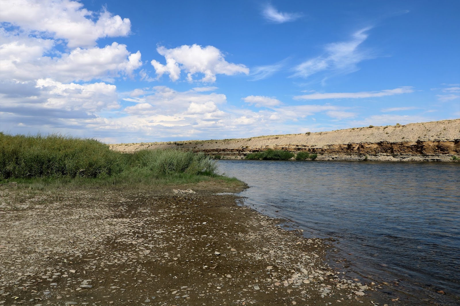
The Green River Sisk-a-dee-agie

Wednesday

Day #68, August 25, 2017


This morning we took field showers and headed out back to Boulder then west on CR 106 (county road) Boulder South Road, then #351 west toward Marbleton (population 1,100) and Big Piney (population 552). Big Piney is the oldest permanent white person settlement in Sublette County, WY. I kid you not, white person settlement. Today these towns owe their existence to natural gas extraction, the new economy out west. Big Piney was established in 1879 by cowboys who discovered their cattle liked the sweet native grasses in the riparian areas along the Green River.
Small they may be but each had ample numbers of saloons. We saw big time natural gas well heads, storage pipes and even a pipe laying crew at work. Ultra-Resources Inc. logos and signs everywhere. Google reveals them to be a subsidiary of Ultra Petroleum Corp. which is an independent exploration and production company focused on developing natural gas reserves in the Green River Basin of Wyoming – the Pinedale and Jonah Fields. Ultra-Petroleum is also at work developing an oil project in the Uinta Basin, Three Rivers area in Utah. They also are positioned in the heart of the Marcellus shale in the Appalachian Basin of Pennsylvania. Lots of pipelines out here in this hot, dry country. Take away natural gas and oil out here and lots of money leaves.  
We crossed over the New Fork River, tributary to the Green River, whose course we are generally following as it winds its way southwestward from its headwaters in the Wind River Mountains through some of America’s most spectacular canyon country, Flaming Gorge and Desolation Canyon to name a couple, and finally to a confluence with the Colorado River in Canyon Lands National Park where one can walk a mile to the confluence overlook and gaze down seventeen hundred feet at the exact spot where the rivers come together. The green waters of the Green and the sediment laden, brown waters of the Colorado flow separately and distinctly for several miles down-river from the confluence. Finally, the Green is overpowered by its cousin the Colorado and, bound together forever, they rush onward toward man-made Lake Powell, the Glen Canyon and finally the grandest canyon of then all, the Grand Canyon, which would be grander yet if not for the Fontenelle Dam, Flaming Gorge Dam, Glen Canyon Dam, Hoover Dam and many others.
For us it’s on to La Barge (population 551) then to Fontenelle (population 13), then to the Slate Creek Camp Ground, a BLM (Bureau of Land Management) facility not far from Fontenelle. The Bureau of Land Management has jurisdictional responsibilities for lots of public land primarily in the west and manages for many uses including recreation. Most BLM lands are open to free camping where one can get to, which out here usually means having a four-wheel drive vehicle.
BML is not to be confused with the Bureau of Reclamation, a federal agency with a controversial past as detailed in Marc Reisner’s excellent book, Cadillac Mountain, The American West and Its Disappearing Water. I strongly recommend it for anyone who may be interested in learning about what corrupt government regulators in cahoots with greedy capitalists can wrought in the name of progress. The book is a little dated and Mr. Reisner is a bit of a cynic, but, what the hell, so am I. The Bureau of Reclamation has oversight for and operation of dams it has built throughout the western states for irrigation and hydroelectric power generation. The Bureau is responsible for all the dams on the Colorado River pursuant to the Colorado River Storage Project Act of 1956, a grand scheme to harness the power of the Colorado River to provide electricity to a fast-growing western population, mostly in Los Angeles, at the time Hoover Dam was built, but also to provide irrigation (very expensive Irrigation) for highland farming throughout the basin.
The signs at facilities like this campsite will say that revenues from electricity and water sales have paid for dam construction and maintenance and construction of vast irrigation works. Nothing could be further from the truth. In fact, the American tax payer has always subsidized these projects and conservative, gun toting, get the government out of my business farmers and ranchers in this high dry country have always paid a fraction of the cost and the American tax payer has subsidized the rest. Thus, many conservative, independent minded ranchers and farmers aren’t so independent after all.  
Nice camp ground though, situated on a beautiful creek, with roosting common nighthawks, northern flickers and a great blue heron. Emily is taking a walk, I’m writing while sipping a 9.5% Detour IPA by Uinta Brewing Company out of Salt Lake City, the wind is whistling through the cottonwoods and willows and I have no knowledge of what out idiot president has vomited forth lately. Life is good.

Slate Creek, Green River Tributary


Saturday

More Travelogue


Day #29, July 17


Left the Tobacco River after sighting four deer and four common loons working their way up stream having breakfast on nice cut throat fingerlings. Lip smacking good I bet. Entry into Canada at Roosville, British Columbia, just north of Eureka, MT. Traveled Route # 93 north. In Cranbrook, BC we purchased a SIMS card from, which did not work worth a hoot, at least not for texting back to the US. Got some Canadian money. Exchange rate 1.2285 Canadian = 1.00 US dollar. Camped at Marble Canyon in the Kootenay National Park, north of Radium Springs. $4.50 Canadian money.  

Day #30, July 18

Entered Banff National Park after a quick run south to the town of Banff. Just the kind of place I like to avoid. Hordes of people, convoys of cars, legions of recreational vehicles and every kind of artisan food, beer, wine, chocolate, yogurt, coffee, trail gear, trail mix, yoga classes, etc. to separate you from your money. But the open pit barbecue sure looked good. Every imaginable film, lecture, tour and virtual experience you can think of to describe the Banff experience. The new Canadian economy. REI tourism. Camped at Waterfowl Lake in the north end of the park. Lots of smoke for central BC fires. Mountains just barely visible.

Day #31, July 19. Drove through Banff and marveled at that magnificence place, except of course for the hordes of people, Glaciers, fast flowing rivers draining those glaciers, filled with gravelly sediment. (glacial till, glacial milk). Other streams running crystal clear and ice cold. Saw caribou, mountain goats, a black fox, big horn sheep with young, bald eagles. Walked the Skywalk Trail which included a plate glass floored veranda, built out over a canyon chasm where one could, while holding on to the convenient rail to avoid vertigo, look between one’s legs and gaze downward eight hundred to a thousand feet into a gorge at a river, discharging freezing water and thousands of tons of chewed up and spat out fine hard rock sediment from the Columbia Ice Field about seven miles away, over which we walked after boarding a monstrous ice tractor that weighed sixty thousand pounds, had three driven axles, five and one-half foot diameter tires, cost one and a half million dollars to build and carried forty passengers down a twenty percent grade over a lateral glacial moraine to the ice field. And to really cap it off the monster was driven by a chipper twenty-three-year-old recent business major college graduate headed for law school next year who could have doubled as a field geologist.

Capped off a stunning day by camping in the “overflow” camp area for the Snaring River Camp Ground. Perfectly adequate accommodations for the travel weary. Went into the town of Jasper (more artisan attractions) for provisions. Lovely quiet night. Watch a young lady traveling alone write in her journal and wondered what she was writing.         

Day #32, July 20

Drove west on route #16 to Mt. Robson Meadows Campground very close to the towering Mt. Robson, at three thousand, nine hundred and fifty-four meters, the highest peak in the Canadian Rockies. We paid twenty-eight Canadian dollars for this one. Worth every penny. 

Day #33, July 21

In the early morning Emily saw a black bear walking through our campsite. We took showers, our first in a while (get over it), spoke to an attractive sixty-two-year-old, very young woman, traveling alone hauling a seventeen-foot Casita Travel Trailer behind a Dodge Ram six-cylinder diesel pickup truck, who, a year ago, had sold her house, downloaded her possessions and had decided to live a nomadic life. And now she was doing it. She was delightful to speak with, invited us in to her Casita and spoke about her life on the road.

We traveled west on route # 16, then south on the Yellowhead South Highway to Valemount, BC, where we gassed up and had an overpriced breakfast at Abernathy’s Family Café. At Valemount is where we reached a fork in the road and, as Yogi Beira once said, “When you find a fork in the road, take it”. Which is what we did. Southward we went because, as it turns out, central British Columbia was on fire. We had been contemplating traveling on to Prince George then even further to Prince Rupert, then boarding a ferry for a five-hundred-mile ride down to Port Hardy, Vancouver Island, but, because of the fires, northerly roads were closed and sixty thousand people had been or were in the process of being evacuated from the area. Sixty thousand.  Central BC is hot and dry, very dry. The coniferous forest is like a big tinder box. One match, burning cigarette, or unattended camp fire and up she goes.

Southward we went, down the Yellowhead Highway. We saw a female black bear with a cub cross the road. Had to stop while the smashed to smithereens remains of a truck and a few cars were removed from the road. Had to have been casualties but they had been removed before we got there. Not sure what exactly happened but for sure people drive fast out here and sometimes pass in most precarious circumstances. We have seen it more than once. People passing three, four cars at once, on hill tops, on double lines. A unique and insidious craziness possesses some folks when they get behind the wheel of a car. They will risk their lives and put others a risk to get somewhere just a little faster. Always amazing to me.

On we go through Blue River and Clearwater and take highway #24 westward to Goose Lake to a beautiful camp site overlooking the lake. No one else there. Easy access, clean, just painted toilet, clear lake water, resident loons, a hummingbird, picnic tables, fireweed, ox-eye daisies, yarrow, rocky mountain cow lilies covering portions of the lake, many other flowers. Grey jays, stellar jays, grouse, a bald eagle coming and going, osprey. What more could a traveling couple want? Stayed in this spot for two days.    

Day #34, July 22

Another couple came in, traveling from Belgium. Had flown to Quebec and driven across Canada to BC. Delightful young couple, camping their way westward. Had just come from Vancouver Island where we are headed. Gave good advice and showed us the book to have, Camping Free in British Columbia, a compendium of every known free camp site in the entire province. Very useful. They swam and bathed naked in the frigid lake.

We took a walk around Goose Lake which we renamed Loon Lake in honor of the four resident loons. I complained about all the damn trees in the way impeding our view of the lake just about the same time we came to a cleared area and were presented with an unobstructed view across a beautiful arm of the lake. I said, “now if we just had a bench”. Emily looked to the right and said, “well, there’s your bench”. And there it was, a very comfortable iron bench. Further inspection revealed to flat head stones with engraved remembrances. “In memory of Mike March, November 11, 1943 – June 13, 2013” and “In Memory of Mike’s Best Friend, Misty. February 1, 2002 – May 11, 2015”. We sat for a while, silent, lost in thought.

We returned to the campsite. That night Emily and the Belgium couple, Sarah and her boyfriend who were camped right beside us, reported that they had heard wolves. The boyfriend smiled as he also reported that I was snoring so loud he thought it was a bear.

Day #35, July 23

Headed west on Rt. #28 to 100 Mile House, south of 150 Mile House and north of 83 Mile House, 70 Mile House and Lillooet which marks mile zero on the Frazer River gold rush days. Lillooet, one of the oldest towns in British Columbia, which rivaled Chicago and San Francisco in size at one time. Camped free at Seaton Lake recreation area. Clean toilets, water. A lovely young couple camped beside us, Jon and Madeline. Professional photographers. She advised me about cameras to buy. Jon graduated from the US Naval Academy, just got out of the Navy and now they are traveling around taking pictures and deciding what to be when they grow up. Eventually, I bought the camera Madeline recommended. Beautiful and very dry aspen, lodge pole pine, Douglas fir forest. On through Clinton where we saw hundreds and hundreds of acres of recently burned forest. And I mean burned, right down to the soil.

Day #36, July 24

Route #12 south out of Lillooet, down Frazer River Canyon. Impressive tunnels and an air tram across the river. One hundred and fifty-four separate fires reported this morning, burning out of control in BC. Route #7 west at Hope (population), touched north Vancouver where the Fraser, Thompson and Harrison Rivers come together to form a grand delta of sedimentary soils brought by these mighty from as far away as Banff. On past Vancouver, back in the good old USA at Sumas, BC and on to Bellingham where we checked in to the Bellingham Guest House for out very first motel stay on the trip. Showers and laundry.

Day #37, July 25. Bellingham GH. Visit with Henry

Days #38 and #39, July 26, 27 Stayed in Henry’s front yard, toured around Bellingham.

Day #40, July 28

Left Bellingham, south on I5 to Marysville for a visit to Cabela’s, then on to Anacortes where we boarded a ferry for Sidney, British Columbia on Vancouver Island, for a grand adventure. Drove west to Nanaimo through heavy traffic to camp at the private Living Forest Camp Ground for our very first camping rip off. Forth-five American dollars a little place to back Flicka II into and additional money for showers which we didn’t buy. Worried about how camping would be on the island but, as it turns out, once we got off into the hinterlands, we camped free for the rest of our visit.

Day #41 and #42, July 29, 30.

On to Arrington to meet up with Captain Tricia Birdsell and her boyfriend Keith. Tricia is the very person who, in 2005, sold us Flicka, out able thirty-two-foot Allied Seawind ketch which we have greatly enjoyed since then. Tricia is a licensed and certified captain. She is from Quebec and has lived throughout northwest North America, New Guiney, California, etc. She has owned numerous sailboats, solo sailed in open oceans and taught other women to sail. When we met her in 2005 she was living aboard Flicka in Fort Lauderdale, Florida. We spent a short time with her then, bought Flicka and have not seen her since, until now. She and Keith live in Qualicum Beach, Vancouver Island in a great condo just across the street from a liquor store. Now that’s convenient. We had a delightful lunch in the Qualicum Market highlighted by a scrumptious curry chicken soup and then headed out on route #4 from Qualicum Beach to Port Alberni then on to camp in the British Columbia National Forest at Snow Creek on the road to Sproat Lake, on the shores of the Taylor River, which we learned is filled with cut throat trout. Keith and Tricia followed us in their VW Camper Van to a beautiful site surrounded by Douglas Fir, Western Red Cedar, Ponderosa Pine and five-foot-tall woodland ferns. We were the only people there in this free site.  

We had a delightful dinner and visit with our friends and retired as old codgers do at just after the sun went down. In the night Emily reported to me that she heard some clicking noises outside. I was having none of that and rolled over to go back to sleep. About six o’clock the next morning I was up to make coffee and, upon opening the van door, was surprised to see to mice scurrying about inside. Quick little buggers they are too and not interested in vacating the van. 

Well let me tell you. Back in Montana where we had the van serviced the guy in front of us at the dealer was there to have a mouse carcass removed from the duct work of his Dodge van and it cost him six hundred dollars. So, at six o’clock in the morning on the Taylor River on Vancouver Island, British Columbia seeing two robust rodents running rambunctiously throughout the van, especially since we had been munching nuts, apple fritters, potato chips, fruit, cookies, crackers, cheese and every other junk food known to man for four thousand miles as we crossed the USA and parts of Canada, not to mention the food box in the back filled with anything a country mouse could possibly desire, was horrifying to say the least.

Nothing else to do except empty out the van of everything we own and go on a mouse hunt. Which is what we did. Our two intruders, two so we thought, went scampering from hiding place to hiding place as we removed stuff. The duo finally disappeared into the heater duct work. Then we turned on the heat full blast to encourage an exit. One furry fiend made a run for it and disappeared instantly into another concealed cranny.

Much to my surprise, I promise I’m not making this up, I spied a mouse trap laying on a big rock in the fire ring. Imagine that. It just so happens at that point in time I was in need of a mousetrap. I suppose that it’s presence there could be interpreted as a warning to future campers that we were encroaching on a mouse haven.

I loaded that sucker up the Jiffy peanut butter and placed it in a logical place, right where I would suspect a mouse to be, being an educated man with great experience in these matters. Within fifteen minutes we had our first mouse. A half an hour later we had mouse number two. Surely, we could not have had more than two mice in the van. I set the trap a third time but no mouse. I declared the van a mouse free zone. We went through our food and bags to see the extent of the damage. Aside from a few bags nips and some droppings it looked as though we had dodged a bullet, or at least a serious mouse invasion. Gear stowed away, we went on our merry way. We met up with Tricia and Keith in Ucluelet, had lunch while watching life unfold on an embayment of the Pacific Ocean and then said our goodbyes. We traveled on alone through Long Beach and the Pacific Rim National Park to Tofino, the end of the line on the southern Vancouver Island shore.

Just to be sure, we bought four mouse traps in Tofino. There was no available camping on the south shore in this area and after stopping at some marvelous places the hour was late so, imagine this, back to mouse haven we went. It really is a beautiful place and so we were very careful about opening and closing the van doors. But now we were fully armed, with multiple, brand new traps. We had dinner, enjoyed the evening and retired in our regular, old codger time. But not before I set four traps. As sure as I am wearing clean underwear in short order we had caught four more mice. One more round of freshly baited traps produced one more mouse. So now are up to seven. I set the traps a final time and I am happy to report that in the morning we had not caught another mouse. So, I cautiously declared the van mouse free. And away we went.


Day #43, July 31

We headed back to Qualicum Beach. On the way, we stopped to walk through a magnificent virgin Douglas Fir forest. From Qualicum Beach we drove on route #19 past the town of Campbell River. All the free dispersed camp sites were full by the time we started looking so we ended up camping in a recent clear-cut on rock Bay Road. Not so bad actually. No bugs and we were by ourselves.

Day #44, August 1

We continued northwesterly on Route #19 to Port Hardy, the end of the line on the northwest coast of the island. Two hundred miles from Campbell River with nothing in between except majestic northern forest on steep mountain slopes. Loggers country. Walked the docks of the city marina in Port Hardy and met nurse practitioner David Hale who since 1996 has lived by himself aboard a thirty-two-foot, ocean cruising cutter, port of call, Ketchikan, Alaska. During that time, he has cruised up and down the inner passage from Anchorage to Washington state administering health care to all manner of folks living in this grand and remote country. Before that he traveled all over the world doing that same work, often in very remote indigenous communities and often as a volunteer. Just another remarkable person we met on the road. After a look around Port Hardy and Bear Cove, we traveled east on route #19, then south on Route #30, the Port Alice Road, to yet another free camp ground, this time on the Marble River. We left Flicka II at the campsite and traveled to Port Alice, another end of the line hamlet on a Pacific Ocean Inlet on this remarkable island. The south shore of Vancouver is chopped up by dozens of long, deep, fiord like inlets filled with clear ocean water and seasonally brimming with multiple salmon species. After talking to a few local characters who proudly proclaimed that they lived in paradise and visiting the ever-present liquor store for necessary provisioning, back to our home away from home, the Marble River for a restful night.

Day #45, August 2

We left Flicka II at marble River and drove to Port McNeil, where we decided to do a little whale watching. We went to a visitor center where a charming young woman carefully explained all the different possibilities. All required reservations except one, North Island Tours. Owner and chief bottle washer, Dave Iskra. His boat, a twenty-six-foot, heavy duty Zodiac with twin, one hundred and fifty horse power gas engines, was parked at the town dock. We called, he answered. He had a trip planned for right then. In ten minutes, we were outfitted in bright orange flotation suits which he said would extend our lives for maybe forty-five minutes if we went overboard but at least we would be floating and therefore easier to find. We boarded the boat with four other intrepid travelers and away we went. He has just this year started his business. Prior to that he was a tree feller for thirty-five years. You read that right, a tree feller. For thirty-five years he worked in remote parts of Vancouver Island, living in logging camps and felling virgin timber. He said the largest tree he ever cut down was eighteen feet across. “You mean eighteen feet in circumference, don’t you?”, I said. “No”, he replied, “eighteen feet in diameter”. This adventure requires a separate story, but I’ll sweeten the pot by just saying that it included a float among one hundred or more foraging Orca whales.  After that everything else was boring. Dave complained about having to go to work each day in such boring surroundings. At the end of the day we returned to Marble River to debrief.

Day #46, August 3

Drove from Marble River back to route #19 then east to Campbell River, then west on route #28 to the Strathcoma Dam and a British Columbia Hydro managed free campsite. BC Hydro is the biggest hydroelectric power provider in the province. The site was packed with supersized recreational vehicles, four wheelers and power boats. We carved out a nice site overlooking the Campbell River. Good for the night.

Day #47 and #48, August 4-5.

Traveled back to Campbell River then to Qualicum Beach for a final visit with our friends Tricia and Keith then on to Naniamo Beach where we boarded a ferry at Duke Point bound for Vancouver, BC. Skirted Vancouver, entered the good old USA at Blaine, WA and drove to Bellingham where we camped in Henry’s front yard.

Day #49 and #50. August 6-7.

Mover Flicka II to the back yard of a cottage on Bellingham Bay, looking out to Lummi Island, one of the San Juan Islands. The cottage is owned by Greg and Heidi Summers who Henry works for occasionally. They had extended a most appreciated invitation to us to camp there. We watch the eight-foot tide come and go.

Day #51, August 8.

Moved back to Henry’s for the night.

Day #52, August 9.

With Henry we drove south, bound for Mount Saint Helen’s. Camped on Slate Creek Road near Packwood, WA, in the Gifford Pinchot National Forest.

Day #53. August 10.

The trip to Mount Saint Helen’s was not working. Winter damaged roads were closed so the approaches we were used to were not available. We drove north onto the Olympic Peninsula, bound for Port Townsend. Short of that we camped on Brown Creek in the Olympic National Forest just west of Hoodsport. We got the last spot.

Day #54. August 11.

A long day of travel back to Bellingham via Port Townsend on the Peninsula where we had planned to board a ferry for Whidbey Island and then work our way back up to Bellingham via Port Angeles. At Port Townsend, we learned that one of the ferry boats had ran aground so there was only one boat in service. That meant that they were turning away anyone who did not have a reservation. That would be us. Even people with reservations were waiting for three days. So, we backtracked south to Kingston where we waited for an hour and a half to board a ferry to Seattle, where we hit a wall of north bound traffic moving at five miles an hour. Weary we were when we got back to Bellingham at 6PM and camped in Henry’s back yard.

Day #55. August 12.

Left Henry’s compound, south bound for Burlington and then eastward on Route #20 through Hamilton, Concrete, Newhalem and Diablo, then across Washington Pass (5,477 feet) to a fine campsite at Lone Fir. The last site was ours for the taking. Next stop tomorrow, Twisp, WA. This route to Twisp is something special because it is the same route our remarkable, sometimes maniacal, son took just last year from Bellingham to Twisp, on his bicycle, one hundred and sixty miles, across Washington Pass at night to arrive in time the next day to run a sixty-mile foot trail race. Who ever heard of such a thing.

Day #56 and #57, August 13-14.

Drove into Winthrop then Twisp. Were able to contact Dorothy, Emily’s sister. Dorothy and Bob, her husband, had flown to Seattle from Anchorage, AK where they live, had bought a brand-new Subaru Forester and were planning to meet friends in Bend, Oregon and drive out to a logical place to see the sun eclipse. It turned out that their route from Seattle included a drive to Twisp so we made plans to meet them. Emily and I secured a fine camp site on Early Winters Creek and sent Dorothy the Latitude/Longitude coordinates and on Sunday they drove right to the campsite. Isn’t technology cool. Great visit.

Day #58, August 15.

Had breakfast with Dorothy and Bob and caravanned our way down the Methow Valley on route # 513 to Pateros where the Methow River enters the mighty Columbia. We had lunch with our western family, said our good byes, turned left and headed for the Grand Coulee Dam, the world’s largest concrete structure and the bane of salmon everywhere. Thanks to the Columbia we saw acres and acres of peach, cherry and apple groves. On the way to the Grand Coulee we passed Chief Joseph Dam at Bridgeport, the second largest electricity producing dam in the US. It powers Seattle. Dams, the diversion of water from dam impoundments for irrigation and hydroelectric power generation have made it possible for people to live in large western cities and enjoy sitting in traffic for hours. On we drove across the Columbia Plateau through the driest country one can imagine, green only where water had been diverted and pumped from the Columbia. Through peach, cherry and apple groves and then through tens of thousands of acres of golden dry land wheat, much of it being harvested by the biggest combines in the world. On to Spokane and Coeur d’Alene, Idaho on Interstate #90, then south on route #3 past an elk farm to a campsite on Rose Lake.

Day #59, August 16

Today’s objective was to head down to Hamilton, MT to visit with our beautiful daughter one more time before we headed back east. We took a little diversion over to Murray, Idaho. And boy am I glad. Today Murry’s population is twenty-seven. In 1889, it was thirty. From 1890 to 1891 the population grew to twenty thousand because gold was discovered in “them thar hills”. In spite of its size, Murry has a very fine museum, in part about the history of gold mining, but also about frontier life in this harsh wilderness with all its colorful characters. More on Murray later. On to Hamilton for the night. A wonderful supper of fresh salmon, asparagus and potatoes and cucumbers from Sarah’s garden, Chad’s fine home brew.

Day #60, August 17

Drove south from Hamilton on route #93, then on route #43 east along the Big Hole River, to Anaconda on route # 569, then on interstate #90 to Livingston and on to McLeod for a visit with a great friend from Staunton, Paula Rau, who lives part of the year in a beautiful log house on the Boulder River with her two beautiful black horses. She fixed a wonderful dinner of grilled shrimp and vegetables, corn on the cob, and peach cobbler for desert. Showers and an oh so comfortable bed for the night.

Day #61. August 18.

Paula got us on our way with bacon and eggs, fresh raspberries and plenty of coffee. We headed east on route #90, then south on route #78 at Columbus, to Red Lodge on route #212. Crossed into Wyoming at Beartooth pass at 10,947 feet. The winding and steep road from Red Lodge to the pass offers stunning vistas of the Yellowstone River Valley and dizzying looks down thousand-foot slopes to river carved canyons, as it winds its torturous way through the Absaroka-Beartooth Wilderness with Granite Peak just to the west, at 12,799 feet, Montana’s highest mountain. We dropped down the south side of the pass into Wyoming and camped at the Beartooth Lake Campground. Last available site. Everybody is gearing up for the eclipse. We have heard horrible stories of the immense crowds expected to be gathering along the eclipse center line from its start in Oregon all the way to South Carolina.

Day #62. August 19.

We left Flicka II at the Beartooth Campground and traveled down route #296 along the Clark fork River then route #120 to Cody, WY then west on route #14-20 toward Yellowstone National Park. Route # 296 was open range land and sure enough we saw a cattle drive, complete with two cowboys on horseback, decked out in cowboy regalia, spurs and all, with two very intelligent looking cow dogs and fifty Black Angus cattle. Route #14-20 past the Buffalo Bill Dam and along the Shoshone River to the east entrance to Yellowstone National Park. Traveled westward across Sylvan Pass, to Yellowstone Lake, along the course of the Yellowstone River to Yellowstone Falls, past Mount Washburn at 10,243 feet, then out to the northeastern entrance. Saw hundreds and hundreds of American Bison. That night back to the Beartooth Campground.

Day #63, August 20.

Drove to Cody, WY then to Meeteetse then into Thermopolis and south along the Bighorn River into the magnificent Wind River Canyon complete with three tunnels through granite bed rock. On to our final destination for this part of the trip, the Wind River Indian Reservation and Ethete, WY, to visit with our new friend, Sister Teresa, a Franciscan nun and teacher who moved to Ethete twenty years ago for a one-year assignment and never left. Her story and my story about Ethete, and what brought me to this place are coming soon. Stay tuned.

Day #64. August 21. ECLISPE DAY, 2017 through Day #66, August 23, 2017

With Sister Teresa leading the way we drove to Saint Stephen’s Mission where we had the singular experience of a full on solar eclipse. The people gathered here are Catholic priests and nuns, about one hundred native members of the Arapaho and Shoshone Indian tribes and us. After the eclipse, we headed out from Ethete to Lander where we hit a wall of traffic coming from all directions. A thirty-mile-long wall. Dead stopped. Eclipse seekers. But we out smarted them. With some help from a friendly US Forest Service official in the Shoshone National Forest Visitors Center, who showed us how to take 5th street from Lander up to Sinks Canyon Stare Park and enter the Shoshone National Forest for free camping and no crowds. Which is what we did. We camped at two different spots in this high country and at the moment are at N 42, 32.007 – W 108, 48.191. Eight thousand five hundred and ninety feet above sea level.

Day #67. August 24, 2017

Last night three mule deer, two does and a buck, walked carefully through our campsite. This morning we left the Shoshone National Forest after two nights of roaring evening campfires made from down and dead Ponderosa Pine and Douglas Fir. Very much appreciated as the temperature plummets quickly in the evening here. Last night the low was thirty-four degrees. Traveled south on route #28 past South Past and South Pass City. Thousands of westward moving emigrants passed by here on the Oregon Trail in the mid-19th century seeking Starbuck’s cappuccino and gold to buy it with.  Saw about fifty antelope near the pass. For us it was on to Farson, then north on #191 to Boulder and finally to Pinedale, jumping off place for intrepid souls to enter the Wind River Mountains, sporting four thirteen thousand plus mountains with Gannett Peak being the highest point in Wyoming at 13,804 feet. We came here today partly to honor our good friend Joe McCue, who at the age of sixty-nine and with two artificial knees and an artificial shoulder, along with his beautiful, strong son Mikie, is coming out here in a few days to trek (that would be to walk – mostly uphill – very uphill) into the Titcomb Basin in the Wind Rivers and mountaineer their way around these majestic peaks and do a few easy accents. Yea, easy! But mostly we are here to pick up a cup of Starbuck’s cappuccino. No surprise, no Starbuck’s in this town of two thousand, but we did have a big, big breakfast at the Wrangler Café.

After a visit to the National Forest Ranger Station for maps and advice and provisioning, we headed back down south to Boulder, then east on #353, then north into the Bridger Teton National Forest to Boulder Lake Campground (N 42 51 442 W109 37 055) for the night for another fine camping evening. Temperature dropping fast. Took a sunset ride into the prairie and saw eight antelope.

Lots of stories to come. I hope I have readers. Good night all.

Thursday

Travelogue Days 12 through 29


Catch up travelogue. There are some stories hidden in this chronology. I will get to them.

Day #12 and #13. On Friday, June 30 we drove from Broaddus, MT where we encountered Chance Lambert. Camped for two lovely days in the Custer National Forest, twelves miles north of Rt. 212. Remote site one other camper. Great toilets as usual. Quiet camping getaway.

July 2, 2017, we headed west on 212 to Lame Deer, MT, in the Northern Cheyenne Tribe Reservation. At a reservation IGA a friendly Native American told us about an Indian Pow Wow that was going on just east of town. So away we went. A community gathering of many Native Americans and others, a parade, complete with mounted cowboys, cowgirls and one Indian chief in dazzling, full head dress. Dancing and drumming competitions. This was the last day of the Pow Wow, so we traveled on to the Little Big Horn National Monument at Crow Agency, MT where on June 25-26, 1876, Col. George Armstrong Custer, two of his brothers, a nephew, a brother-in-law and two hundred and sixty-nine American Army troops met their bloody deaths at the hands of a band of Northern Cheyenne, Lakota Sioux and Arapaho Indians lead by Sitting Bull, Crazy Horse and Chief Gall.

The massacre of three hundred Lakota Native Americans, two hundred of which were women and children took place not far from Crow Agency, on December 29, 1890. at Wounded Knee, South Dakota, then and now the Lakota Pine Ridge Indian Reservation. We went here also.

These were sad times for Native Americans.

The victims of the Wounded Knee massacre were buried in a mass grave in a community cemetery along with many other local Natives Americans dating to the present. Ironically, many of the more recent burials were natives that served in the US Armed Forces in World War I and II, and Vietnam. Some of these were almost certain to be related to the massacre victim’s families.

On to Billings, MT. then north to Roundup (population 2000) and east to Musselshell (pop 100) where we stayed in a free town campsite with water, acceptable toilets in a cottonwood grove, on the Musselshell River. Day #14.

July 3, 2017. Day #15. Back to Roundup for July 4 weekend festivities, which were prodigious to say the least. Parade, beer barrel tug of war, rodeo, music and other activities. Spoke to the festivities coordinator who moved here five years ago to uncomplicate her life. Mow she’s the events coordinator for the town. Go figure. Drove north on 87 to Grass Range, MT (population 110) through some of the driest country we have encountered yet. The only store for fifty miles. Lucky for us they had ice cream. The store attendant told us it had not rained since early spring and that there was very little snow cover this past winter. Saw a guy carrying a side arm and wearing a beaver skin hat. That was enough to spur us on to the Charles M Russell National Wildlife Refuge on the Missouri River, another fifty-mile drive on hot dusty roads. We camped on the river in a delightful spot and met the camp site host couple, Fred and Carol, who just happened to be from Hamilton, MT, where Sarah, my daughter, is living. In the evening, we drove a twenty-five-mile loop tour through the refuge looking for mule deer and elk.  Deer but no elk. Saw a really old ghost homestead. Ninety seven degrees at 9:00PM. That night it got down to fifty-eight.

July 4, 2017, Day #16. Headed north 191 to Zortman MT (pop 69). We had heard that those sixty-nine souls and a few others in the area put on quite a grand annual July 4th parade. With that many people involved we figured we might be the only spectators. On the way in we noticed smoke in that direction, talked to people closer to Grass Range who told us about a fire burning pretty much out control in the Fort Belkap Indian Reservation, which the village of Zortman borders. When we got there a friendly local sheriff informed us that Zortman was shut down and the good people of the town had cancelled the parade. But he would certainly allow us to go in to fuel up. Which we did. In the town square, and I use that term loosely, there were three recreational vehicles parked side by side with a few grizzled cowboys sitting in a row in lawn chairs. As we rode by I asked about the parade and one old cow poke said, “Well, turn around right up there, drive back by and wave at us, we will wave back, and there’s your parade”. Which is what we did. Peals of laughter from those old tanned, wrinkled faces. In fact, the parade had been canceled and the town’s people were planning a “I survived the fire” parade to occur in a couple of weeks. On the way, out we saw fire jumpers preparing to go into that steep, hot, dry, burning land, mostly Native Americans, going out to protect Zortman and its people. We watch a helicopter tanker dip a bag in a local lake and make a run into the fire. Very dramatic.

On to Hays in the reservation where we rode through a canyon, saw a natural bridge and visited the St. Paul’s Catholic Mission. Then on to Havre, MT and west to camp free at the Fresno Reservoir. Complete with jet skis, power boats, many large recreational vehicles, generators, lots of noise, clean toilets (sort of). Managed to carve out a relatively pleasant camp site on a hill away from the chaos below, with a commanding view of the lake. As evening crept in and the hubbub below lessened, a beaver swam by to restore my faith.

July 5, Day #17. Back to Havre to service the Dodge then south on 87 to Big Sandy (population 600) then east for forty-four miles on a gravel road to Judith Landing and the confluence of the Judith and Missouri Rivers, where we camped on the banks of the Missouri River in a very nice, clean and free site. Right out there, one hundred yards from the shore Meriwether Lewis and William Clark with Sacajawea and her infant son and a few very brave young men passed by in heavy wooden boats in their exploration of the Louisiana Purchase. The story is that Napoleon didn’t know what he was selling and Thomas Jefferson didn’t know what he was buying in that deal, so Lewis and Clark headed west from St. Lewis to figure that out. Along this stretch of the river, there are a number of places where archeologists and historians have determined that Lewis and Clark camped. I looked out over those waters and imagined them coming by in those heavy wooden boats, headed up the river against a strong current, sailing in a favorable wind, most likely rowing or poling their way along, or using mules on the banks to haul the boats along in one-hundred-degree heat. Today, here at Judith Landing the temperature got up to one hundred and six. By the way, we read that William Clark named the river, the Judith River that is, after a young lady he knew who lived back in Virginia. I want to find out more about that deal.

We met the camp hosts, Marge and Craig Purdy, from Stevensville, Mt., just ten miles from Hamilton where my lovely and talented daughter lives. Great camp site. Very remote. Paid $2.50 for clean toilets and site overlooking the river. Took a swim. Great toilets, hand sanitizer, waste baskets plastic bags, no spiders. A big plus for Emily, who is bug adverse.

July 6, Day #18, Headed south to Winifred, thirty miles over gravel and dirt. Had one-pound hamburgers in a café casino. Watched a woman eat French fries and feed a poker machine about fifty dollars. Very expensive French fries. Then drove south on 191 to Harlowton. Saw mule deer hopping their way through tall, irrigated wheat. Camped at Spring Creek in the Lewis and Clark NF, another very pleasant sojourn. Met a woman in her eighties driving a big diesel truck and hauling a recreational vehicle by herself.  

July 7, Day #19 -21. Hamilton, MT. Spent three days with Sarah and Chad, my daughter and son-in-law, who, in a fit of wanderlust, moved here last April, where she is a nurse practitioner in a local setting. They are living their dream in the Bitterroot Valley surrounded by mountains, elk, mule and whitetail deer, sandhill cranes, wild turkeys and cowboys and Indians.   

July 10, Day 22, Monday, headed north to National Bison Range, a magnificent wildlife preserve, where we saw bison, many elk, deer and antelope. Camped at Finley Point State Park, Flathead Lake. No more state parks. Expensive and crowded.

July 11, Day 23, Disaster. Headed for Kalispell, MT. A fellow motorist flagged us down to point out that we were dragging our power cord. The dope driving the van forgot to connect it this morning. Had to replace the cable in Kalispell. Headed out toward Glacier National Park where all camp sites were full. Not an uncommon phenomenon in American’s national parks.  We camped in the Flathead National Forest in a remote, free site, ten miles on gravel roads. Beautiful lodgepole pine, ponderosa pine forest.  

Days 24 and 25. Stayed at Avalanche Creek Camp site in the magnificent Glacier National Park and toured around with one hundred million other folks. Big horn sheep, mountain goats, spectacular mountain scenery, narrow, winding road across Logan Pass. An ironic name for a national park today. When the park was established in 1910, it had about one hundred and fifty glaciers. That number is now at thirty-seven. Since 1966, ice locked in glaciers has declined by thirty-seven percent. Going, going, gone.   

We left the park on July 14, and spent days 26, 27 and 28 on the Tobacco River just outside of Eureka, MT. about fifteen miles from the Canadian border, in one of our best camp sites. On a bluff overlooking the river. Free, clean toilets. It was a weekend, so there were a few locals coming and going, kayaking, fishing. One other camping group. Turns out we were camped right on the Pacific Northwest National Scenic Trail, that starts in Glacier National Park and winds itself for over twelve hundred miles across the Rocky Mountains, the Selkirk Mountains, the Pasayten Wilderness, the North Cascades and the Olympic Mountains from Glacier National Park to Cape Alava, WA on the Pacific Ocean. Over our three-day stay we watched over thirty intrepid souls walk by headed for the Pacific. One guy was carrying over fifty pounds. The next guy called himself a minimalist. Said his “base weight” was twelve pounds. With food and water, the total weight he carried was twenty-two pounds. Fantastic people. Each a world of stories I’m sure. Very pleasant conservations.  

July 16, Day 29 – On to Canada.

Stay tuned for some stories.

Monday

An Old Debt


Hello friends.

Its Sunday, July 16, 2017. I’m writing this while sitting in the shade in our fabulous, USFS camp site on the Tobacco River in the Kootenai National Forest just northwest of Eureka, Mt, about fifty miles from the Canadian border.
Whitetail and mule deer, golden and bald eagles, osprey, northern rough-winged swallows, bank swallows, great blue herons, spotted sandpipers, rufous hummingbirds, common loons and more. We have been camped here for three days, watching birds and a few locals come and go, fishing, kayaking and hanging out.  A few Montana rednecks and evangelicals lurking about, looking for unsaved souls, not the rednecks. Not sure what they were looking for.  Since we have been in this area we have been prayed for and questioned as to our acceptance of Jesus Christ as out personal Lord and Savior. More on that phenomena later.

This spot is smack dab on the twelve hundred Pacific Northwest Trail, not to be confused with the Pacific Crest Trail. We have watched twenty or more hikers go by. One guy’s pack weighed fifty pounds. A young man just went by carrying twenty pounds which included five days food. Lots of ways to get that journey done. Not one of these folks have asked us about our commitment to Jesus Christ. They are on their own enlightenment journey not the evangelical kind. Just now a bald eagle flew by, being vigorously harassed by an osprey. Tomorrow we are headed into Canada.

Now for the story.

This past Friday we were in Hulett, Mt for breakfast. I was backing Flicka II into a tight space and, ever so slightly and gently, turned just a little too tightly and, as a consequence, jackknifed. I heard a little snap, just a little one, one that should have been a warning, but being a college educated man and prone to considering “higher” matters than the sound of tearing steel, I ignored it. What could possibly go wrong. I probably imagined the sound anyway.  

So down the road we went on our way to Broadus, Mt. passing through more scorched and dusty land, through Hammond, Boyes and finally into Broadus, all towns with less than five hundred souls aboard. We are beginning to get into butte country and they are named. East Fork Butte, Morellas Butte, Fighting Butte, Preston Butte.

Our primary objective for being here was to get water, not an easy task in this country. We found out that the local library was the place. The librarians were very nice and gave us a key to the faucet. That’s right, a key to the faucet. While I was attending to that Emily wondered around checking on things. She called out to me that there was something I should look at on the trailer. Which I did and it wasn’t pretty.

My ever so observant captain had discovered that a weld holding the anti-sway bar on to the hitch had parted. An anti-sway bar is not a critical piece of equipment but it does stabilize a trailer and reduce swaying. Hint, that’s why they call it an anti-sway bar. It helps one maintain control if a trailer tire blows out.

So, there we sat. I remained silent for a few moments, painfully remembering yesterday’s snapping sound which was getting louder by the moment, the one I had decided to imagine yesterday. I chose not to tell Emily about yesterday’s jack knifing event. No sense in confirming suspicions she may already have about a certain traveling companion.

It was 1530 on a Friday afternoon in this hot, sleepy, dusty agricultural town. Probably not the best time to find a welder, which is what we needed, after I had come to the painful conclusion that this thing needed fixing. A guy at a Conoco station told where we could find the only welder in town so away we went to Chance Lambert’s shop.

As luck would have it he was not there. But right next door was Lil’s café. Lil’s café looks like the kind of place that Tom Waites would hang out in if he was a poet, musician cowboy looking for material. Plain, quaint and earthy. “Cash only, that means you.” But the waitresses could not have been nicer and Betsy Sue, after hearing our dilemma, pulled her cell phone out and called Mr. Lambert. She got him on the line and after a little chit chat gave me the phone and our adventure with Chance began.

He was in town and supposed that he could help but that I should know that he had a “little” drink. After a guffaw or two by me, I asked him whether it was one drink or five drinks. He said he was starting on his second. I said well I hate to put a damper on the start of your weekend but two drinks don’t sound like a whole lot for a welder. “What could go wrong?”, I asked. “Maybe plenty”, he replied. That got another guffaw from me.

For me the actual task at hand, getting the weld fixed, somehow became less important than meeting Chance Lambert. He hesitated briefly and said, “Well, I’ll just finish this one and come along in a few minutes”.

Sure enough, pretty soon he shows up. I was expecting a grizzled old guy in his sixties with a three-day beard, bloodshot eyes and tobacco stains on his chin, but Chance turned out to be a handsome, clear eyed, beanpole of a man in his late twenties, with catcher mitt hands and an easy-going gait. Slow talker with not much to say at first, but he hadn’t run into the likes of me before, probably had never met a Virginian. Probably not prepared for questions, questions, questions. As it turned out he had only been east one time and that was to Alabama to visit a friend who he had gone to welding school with him.

He looks at the broken weld, disassembles the parts, studies them for a while and goes to work, with me following him around. I started by asking about irrigation in this country. He was very happy to tell me about that and as it turned out he had a pretty commanding knowledge of local hydrology. He spoke about the artesian wells along the river that delivered fifty gallons of water a minute and the shallow dug wells that dotting the prairie that delivered much less. He said if you don’t irrigate here you don’t grow anything.

He went on to talk about growing up on his family’s seven-thousand-acre ranch which he explained was quite small for this country. He said they could support the about three hundred and fifty cattle on it. A more typical ranch in this country is tens of thousands of acres.

After more questions from me he talked about going to college to study welding, his business and driving big trucks on the side. We were having a collegial and happy conversation. Chance was an easy-going slow- walking, slow-talking guy and he clearly knew what he was doing. While we talked he worked methodically, grinding, cleaning and finally welding. Emily asked him about wearing a welding helmet, which he was not at the time. He got all three of his helmets out and explained how each one was different and what they were used for.

The work went well and I got a sense that it was being done professionally and with great care. He primed and painted the finished product which gave us more time for pleasant talk. After an hour and a half or so we were pretty much ready to go on our way. I asked him what we owed him, fully expecting a sizable tab what with it being after hours for him so to speak and certainly a premium figured in since we had interrupted his drinking. He looks away uncomfortably I thought then back and said, “I suspect if you have a twenty in your pocket that will do.” I said, “No I don’t have a twenty, but I have a fifty, and that’s what I’m giving you.” He said, Oh, that’s way too much. There wasn’t much welding to that job.” “Well, a fifty is what you are going to get”, I replied. Back in Virginia if we could’ve even found somebody on such short notice to do a job like this it would’ve cost a lot more.

Then I told Chance a story a story and I’m going to tell it to you now. It goes to part of the reason I gave Chance a fifty. Call it repaying an old debt.

In the mid-seventies, my life-long friend Steve Moore and I were traveling out West. We were driving my 1967 Volkswagen camper van. We had great adventures and one of them took place outside Grand Junction, Colorado. About ten miles to the east, the van engine suddenly quit.  Turns out a pulley had sheared off. On engines pulleys support belts that transfer power to engine parts. No pulley, no go. So, there we sat. Pulled off the road and watched traffic stream by. These were the days of no cell phones, no internet.  But I did have a thumb. I stuck it out and hitchhiked into Grand Junction with my broken pulley. Steve guarded the fort while I was gone. It was about a ten-mile trip to town. By the end of our travails that day he was able to read almost a whole book.

In Grand Junction, there was a Volkswagen dealer but they did not stock the pulley we needed. Go figure. The dealer advised me to go to a certain junkyard and see what they might have. Back then junkyards were not quite as sophisticated as today. Then, one wandered around to find a matching wreck. You find the part you need, pull it off the wreck and pay on the way out. Good idea except I didn’t have any tools. At least not with me. They were back at the fort. Which is where I hitchhiked to next. All the way back to the van. After securing the tools I reversed course and made my way back to the Grand Junction junkyard. Lucky for me people driving by were quite accommodating.

Back at the junkyard things didn’t go so well. No matching pulleys. The junkyard guys told be about a guy on the east end of town who ran a welding shop. Lucky for me. That’s on my way back to the van. So, I went hitchhiking again. Stuck that well practiced thumb out just when a Grand Junction cop rode by and, using a bull horn, politely informed me, an obvious tinhorn, that hitchhiking was illegal in Grand Junction and would net me a one-way jail ticket if I persisted. By this time, I was hot and dry and pretty exasperated but dutifully I walked eastward until I got to the city limits where the thumb went back out.

I made my way to the welder whose name, if I ever knew it, is forever gone to me. He was an older guy and living by himself in a shop with machines, iron, sculptures, trailers, pipe, railroad cars, broken down trucks all over the place, a lifetime’s work of fixing, building and creating big machines, little machines, you name it he had probably welded it. He was a delightful man, easy talk. I showed him the broken pulley.

Did I mention that he was in a wheelchair? He pushed himself around picking up various tools, mounted the pulley on a clamp and began to piece it together, all the while checking for proper alignment, important for a rapidly rotating engine component. He was careful, methodical and clearly enjoyed what he was doing. And he was good at talking and he did most of it. Two things that come to mind were that he had recently lost his wife which he was very sad about and that he was a veteran and that he was very proud to have served his country. I told him a little bit about myself and about the adventures that my friend Steve and I were having. He enjoyed that said that he was from Grand Junction, had always been a homebody and admired people who ventured out to see the world. He finished the weld, ground it down, polished it up and took great pains to examine it to make sure it was true. He handed it to me and said, “that ought to do it.” I said, “how much do I owe you?’ He smiled and said, “nothing”.

I was shocked it was very hard to believe that this guy would not take a nickel but he insisted. We said goodbye and parted ways. I thought we had parted ways anyway. When I went away with my just like new pulley whistling a tune and feeling pretty darn good. By golly we were about to get on our way. I arrived back and told Steve of our good fortune and my encounter with this fabulous guy. I took the pulley to the back of the van where that fine German-made engine set ready to be fired up and that’s when I realized that I had left my tools with the welder.

One cannot imagine the pain that I was in at that moment, a turning point in my life. But I pulled myself together and plodded on.  Faced with adversity one must rise to the occasion.

To Grand Junction I go, hitchhiking my way back once again. I guess the good news of the story is that plenty of people picked me up. My new welder friend and I had a good laugh about my travails. He said he knew I would be back and he wasn’t going anywhere. So, we visited for a few moments and I thanked him again and again and away I went. One more trip back. I was able to install the pulley, replace the belt, fired that engine up and away we went. And all it cost me was a whole lot of hitchhiking. A Steve got to read a book.

So that’s why I gave Chance Lambert fifty bucks. An old debt repaid.

Back at Chance’s shop I shook his catch mitt hand and away we went. After taking our leave of Chance and Broadus, MT. we headed west toward Ashland, MT, left the main road, traveled for twelve miles on a hard packed sandy, gravel road to camp on the East Fork of the Otter River. We were in the Custer National Forest in a remote campground with the usual USFS, very clean, vault toilet. There was one other couple there in a recreational vehicle, the Montana state flower. They cheerfully waved greetings. Otherwise we were alone in this beautiful, hot, dry place. We stayed there for two days.

Thank you for reading this story. It’s not that exciting but it’s true.

My next entry will be a catch-up and I’ll tell you about more the days on the road and our adventures.

Good night and good luck.