Sunday

Day #78, September 4, 2017

Away we go this morning after visiting with the camp hosts, a nice Latino couple from Albuquerque. Onward and upward to Wolf Creek Pass. We straddle the Great Divide at 10,800 feet, within several hundred miles of the headwaters of the Rio Grande, Pecos, Arkansas, Canadian and Red rivers draining to the east and the San Juan, Green and Colorado rivers to the west.


Wolf Creek Pass, part of the San Juan mountain range, averages annual snowfall of four hundred inches, over thirty-eight feet of snow. Sounds like a lot of water, but in the spring, after torrents and torrents of runoff, this region dries off rapidly and by mid-summer and into fall the arid nature of the climate becomes apparent. Water becomes scarce.

Onward and westward to Pagosa Springs, Durango and finally Cortez where I had one of the best burritos ever at Gustavo’s Mexican Restaurant. From Cortez we visited the Anasazi Heritage Center in Delores, CO before we head into the Canyon of the Ancients National Monument. The Anasazi or Puebloan people inhabited this region for centuries and left ample evidence of their astonishing culture.


Don't You Just Hate People Who Do Foodie Pictures?

In the center, we met eighty-one-year young volunteer Nancy Lacell Becker.  Nancy came to this country from Asheville, North Carolina as a young woman and took up teaching theater in various venues including the Ute Mountain Indian Reservation. She got herself a husband and, after a few years, decided she liked Colorado better than the husband so sent him packing. After a couple of more husbands and many adventures she is still here and still teaching.

After a visit to this remarkable museum we head west to the remotely located Hovenweep National Monument located on the Cajon Mesa in the Great Sage Plain along the border between southeast Utah and southwest Colorado, just north and west of Cortez, an area of arid, high desert. Annual precipitation averages between five and fifteen inches depending primarily on elevation. Most of that comes in spring deluges. Spring, summer and fall elevated temperatures and low humidity promote rapid evaporation, so very little water is available to plants and animals. The canyons have some springs and seeps, which is where signs of human habitation mostly occur.

Puebloan Culture Items in the Anasazi Heritage Center


The name Hovenweep, in the Ute language means "deserted valley", apt as a description of the area's dry, desolate canyons and barren mesas as well as the ruins of ancient communities.

Ten thousand years ago nomadic native people visited this region to gather food and hunt. These people used the area for centuries, following the seasonal weather patterns. They built complex square and circular towers, cliff dwellings, kivas (ceremonial structures) and left petroglyphs like those in Mesa Verde National Park not far away. The masonry work is beautiful and skillfully done. Most of the ruins are off the beaten path and require a hike across dry, tortuous and hot terrain punctuated by sage brush scrubland and low growing pinyon-juniper forests.

Hovenweep Scenes


By the end of the thirteenth century, for unknown reasons ancestral Puebloans throughout this area migrated south to the Rio Grande Valley in New Mexico and the Little Colorado River Basin in Arizona. Probably looking for new sources of peyote and a Grateful Dead concert. Pueblo, Zuni and Hopi people are descendants of this culture.

Hovenweep is just one of several national monuments we visited. National monuments are real gems on the American landscape. Far less visited than national parks, in more remote and less roaded areas, but no less spectacular. The National Park Service manages some monuments, the Bureau of Land Management others. They all generally have excellent camping facilities, albeit in remote locations, which is fine by me. Not to get too political, the current administration of idiots under President Bone Spurs is doing what it can to reduce protection of some of these spectacular places.

We drove along a gravel road for ten miles to get to the only campsite in the monument. There were three other vehicles there. The campground was complete with shelter, fire pits, running water, showers and was situated on the edge of a canyon typical to the region. We took up residence there for the next two days.
After we settled in a young man camped nearby walked over to visit. “Hi there, I’m Ryan”, he said enthusiastically. “I couldn’t help but notice your Virginia tags. Where are you from?” I proceeded to explain, assured he would have no idea where Staunton Virginia was. Not necessary. “I’m from Nellysford over in Nelson County”, he said cheerfully. Nellysford is twenty miles from Staunton. Ryan went to Mary Washington College where our son Henry went. He knew Joe Moore who also attended Mary Washington. Joe is the son of Steve Moore my best buddy growing up. Ryan, known as Boomer to the athletic crowd at Mary Washington, is on vacation by himself. He had flown to Albuquerque, rented a truck, bought a modicum of camping gear and was doing what we were doing; having a ride-about. Small world all over again. What are the chances of running into a fellow Virginian, especially one hailing from so close to our hometown, in such a remote place?

Coyotes yipping in the distance. Evening libations, dinner, sunset, starry night.

Tomorrow we go exploring.

Thursday

Day #77, September 3

This morning we left Buffalo Creek on #285 southbound back to Trout Creek Pass and then to Salida on #291. We hailed a woman to ask where to get a good breakfast. Grace was her name and she was walking her dog Gracie. Turns out she is from Chesapeake, VA. Small world. A traumatic divorce and bad memories back east and here she is in Colorado for a fresh start.

On to Dawn’s Café for breakfast. Then south on #285 with the Sangre de Cristo Wilderness just to the east and the Rio Grande National Forest to the west. Through Villa Grove and Saguache where we went due south on #15 to Monte Vista then west on route # 160 to Del Norte and then South Fork where we crossed the Rio Grande River. Camped for the night in the Park Creek Camp Ground right on the South Fork of the Rio Grande in the Rio Grande National Forest. Lucky for us. The campground is closing for the season at noon tomorrow.

A Portion of the Sangre de Cristo Mountain Range to the West. Hot and Dry this Time of the Year.

Day #74 – 76, August 31 to September 2.


Margo, Bob and Captain Emily

Up and gone today to Windsor, CO to visit with Emily’s friends Bob and Margot Iwanchuk, professional meteorologists who came to this part of the country from Bedford, MA. Margot’s brother Duncan was Emily’s beau in bygone days. Duncan and Emily new each other in Boston in the late seventies. The both had the unfortunate experience of having severe strokes in their early thirties.


Bob was a student at Kent State University during the late sixties and early seventies when the horrific shootings on May 4, 1970 of unarmed college students by members of the Ohio National Guard occurred during a mass protest of the Vietnam War. Twenty-eight guardsmen killed four students and wounded nine others. After this tragedy four million students staged strikes across America and hundreds of universities, colleges, and high schools closed. People rose up in opposition to war.

I was a first classman (senior) at the Virginia Military Institute in 1970. What a time to be a student at a military college. While I was learning to fire a 50-caliber machine gun, drive tanks and throw a hand grenade my cohorts at the University of Virginia were protesting the war. These were tumultuous times in America, a contentious, unsettling and sad. Where were you on May 4, 1970?

The sixties were war years, like so many before and after.  During the Vietnam War era, every evening American news anchors reported the number of American soldiers killed that day, the body count. In the end, over fifty-eight thousand American soldiers died. Rarely mentioned were the 1.1 million Viet Cong and North Vietnam soldiers or the 250,000 South Vietnam soldiers or the two million civilians who died in the conflict, or the 4,900 dead from Thailand, South Korea, Australia and New Zealand.  

Nineteen hundred and sixty-eight was a particularly eventful year.

In February, Nguyen Ngoc Loan, a National Police Chief, executed Viet Cong officer Nguyễn Văn Lém.  War journalist Eddie Adams photographed the execution. The picture made its way around the world and help sway US public opinion against the war. Adams received a Pulitzer prize for his reporting. People around the world condemned Loan for his brutality. The underlying story, one that did not get much attention, was that Lem was responsible for killing the wife and six children of a South Vietnamese military officer. A few months after the execution picture, a Viet Cong soldier seriously wounded Loan in a fire fight and a field surgeon had to amputate Loan’s leg. In 1975, during the fall of Saigon Loan fled South Vietnam. He moved to the United States and opened a pizza restaurant in the Washington, D.C. suburb of Burke, VA where he died in 1998. You cannot make this stuff up.

In March the My Lia massacre happened. United States Army soldiers killed somewhere between 347 and 504 unarmed Vietnamese civilians in South Vietnam. The victims included men, women, children and infants. Some of the women were gang raped and their bodies mutilated. Three US serviceman tried to halt the massacre and rescue hiding civilians. Some US Congressman denounced these heroes as traitors. It was only after thirty years that our government recognized and decorated them for shielding noncombatants from harm in a war zone.

In April James Earl Ray assassinated Martin Luther King Jr.in a hotel in Memphis Tennessee.

In June, Sirhan Sirhan assassinated US presidential candidate Robert F Kennedy at a hotel in Los Angeles.

In August Private First Class James Anderson Jr. became the first African-American marine to receive the Medal of Honor for heroism while serving in Vietnam. In a fire fight in December 1966, Private Anderson covered a grenade with his body to save his teammates. The grenade exploded and killed him. He was twenty years old. If that doesn’t make you cry nothing will.

In December the Apollo 8 spacecraft entered orbit around the moon and astronauts Frank Borman, Jim Lovell and William Anders become the first human beings to ever see the far side of the moon.

Margo and Bob were fabulous hosts. They fed us well. The next morning, after a scrumptious breakfast, we drove to Denver to visit another old friend and have the van serviced. The brilliant and talented graphic artist Wendy Ray picked us up at the car dealership and whisked us away to her condominium, where we spent the afternoon visiting, eating Colorado peaches and admiring her art.

The Insuppressible Wendy Ray Holding a Picture of the Equally Insuppressible Lester Bowers 


Samples of Wendy's Art

Wendy drove us back to the dealership and after goodbyes we drove to Colorado Springs and checked in at the Garden of the Gods Motel and Cottage. Some place. A perfect Tom Waites hang out. All manner of colorful people coming and going. Had dinner that night at Rudy’s Country Store and Barbecue Hang Out. Perfect.

The next morning, we drove to the Air Force Academy’s Falcon Stadium to see a football game between the Keydets of the Virginia military Institute (VMI), my alma mater, and a far superior Academy team.

 VMI, a state supported military college, the oldest such institution in the United States, has a student population of about seventeen hundred. The Air Force Academy, a federal service academy, about forty-five hundred. The other service academies are the United States Military Academy (West Point), the Naval Academy, the Coast Guard Academy and the Merchant Marine Academy. Both VMI and the service academies offer rigorous military programs. Some say that living conditions at VMI are more austere that those at the service academies.  That’s code for, ‘we are tougher that those guys’. Cadets at both VMI and the service academies must participate in the Reserve Officers Training Corps (ROTC) of the of the US Armed Forces, but VMI gives cadets the flexibility of pursuing civilian endeavors or accepting an officers commission in any of the active or reserve components of any of the U.S. military branches. Cadets from the service academies attend their respective schools free and, barring extenuating circumstances, must enter a chosen military service branch for a given length of time.


The Virginia Military Institute is the only school in the nation to have had its students, while actively attending the school, sent into battle. On 15 May 1864, two hundred and forty-seven members of the VMI Corps of Cadets fought as an independent unit at the battle of New Market during the Civil War. General John C Breckinridge, the commanding Southern general, held the cadets in reserve until Union troops broke through Confederate lines. Breckinridge sent the VMI unit into battle and, as history tells the story, asked for God’s forgiveness for doing so. In a matter of minutes, the unit suffered fifty-five casualties with ten cadets killed. But the cadets pushed forward, capturing a Union artillery emplacement. The Union troops withdrew, and Confederate troops held the line.  A heavy price indeed to pay for holding a line in a field in the Shenandoah Valley. These remarkable VMI cadets were about the same age as Private First Class James Anderson Jr. who covered that grenade with his body to save his teammates in Vietnam. Six of the ten fallen cadets are buried on VMI grounds behind the statue "Virginia Mourning Her Dead" by sculptor Moses Ezekiel, a VMI graduate who was also wounded in the Battle of New Market.

VMI has a simple and straightforward honor system. It says, “A Cadet will not lie, cheat, steal, nor tolerate those who do.” The system does not recognize degrees of honor. The sanction for any breach of honor is dismissal. Leaving aside the impracticality of implementing such an austere code in day to day living outside an institution like VMI, wouldn’t it be nice if we did not tolerate politicians who lie to us? That would be an effective way to get rid of most of them. Just dismiss the charlatans!

I was a cadet at VMI in 1968 when the Institute admitted the first African-American cadets. In 1997 VMI finally admitted women, shamefully the last military college in America to do so. VMI resisted the whole way. It took a 7 to 1 decision in the US Supreme Court that found that it was unconstitutional for a school supported by public funds to exclude women to finally compel VMI to admit women. Following the ruling, VMI contemplated going private to avoid the ruling. State and federal dollars drive much of VMI’s military programs so when cooler heads ran the numbers and concluded that road would be a dead-end, VMI finally relented and admitted women, who of course have gone on to excel at VMI, in the armed forces and in civilian life. When money talks nobody walks.

VMI is a southern school through and through. Many of its heroes are Confederate generals. To this very day when fourth classmen, ‘rats’, exit barracks through Jackson arch they must salute a statute of Stonewall Jackson just outside of the arch. This is a time in America when many people are contemplating the allegiance we have to these southern Civil War heroes or at least to monuments to them throughout the South. Just across the Blue Ridge Mountains in Charlottesville the city council voted recently to remove a statue of Robert E Lee from a  public park, formerly called Lee Park, now renamed Emancipation Park. Is VMI next?

Schools need big money to fund their athletic endeavors. This game between fine young men on both sides illustrates the influence of money on scheduling in college sports. On this day the VMI football team were severely overmatched. They gave it their all but predictably came up on the losing end. However, the school got a substantial chunk of money just for showing up. Final score of today’s match? Air Force Academy – 62, VMI – 0. It might have been a money maker for VMI but I’m not so sure about a morale builder for the brave VMI players. The VMI team did not win a single game this season. One must wonder whether opening against a fare superior team and getting shellacked in this way contributed to that losing season. Big programs like the Air Force Academy get big, fast, talented athletes. VMI athletes have big hearts but not comparable talent, size and speed.

Football games at Falcon Stadium are festive events, complete with jet flyovers, marching bands, precision parachutists, and an appearance by the team’s mascot, yes, a falcon. Late in the first half medical personnel took the starting VMI quarterback off the field in a gurney after an opposing defender administered a violent hit.

VMI Team Praying that Nobody Gets Killed


Precision Parachutists

That's a Big Flag

The Air Force Falcon

Valiant VMI Quarterback Leaving After Violent Hit


We couldn’t take any more of the slaughter so we left the game at halftime and drove west on route 24, skirting Pike’s Peak, passing through Woodland Park, Divide, Florissant, Glentivar, Hartsel and finally to Antero Junction, where we crossed Trout Creek Pass at 9,487 feet and went north on route 285 to National Forest road 433 where we entered the Pike National Forest for a little sweet dispersed camping, with eight spectacular fourteen-thousand foot and many lesser, but not much lesser, mountain peaks in the Sawatch Range of Colorado’s Central San Wan Mountains just to the west. 

Tomorrow Salida, CO

Day #73. August 30, 2017


We came in late to Aspenglen from our encounter with mother moose and her offspring. Another great National Park Service campground. This morning, after breakfast we returned to Sheep Lake and traveled through Endo Valley, demarked by 13,075-foot Mount Chiquita to the north, 11,620-foot Sundance Mountain to the south and numerous other surrounding high mountains. The valley’s lower portion is an alluvial fan of the Fall River, an area of sediment deposit (alluvium) left behind as the river spills out into an area of less relief. In the distant past during a time when the adjacent mountains were even higher the ‘river’ was a river of ice, a glacier, that had long since retreated and left behind moraines of unconsolidated debris in distinct forms.

Very soon the valley treated us to an impressive herd of fifty to seventy waapiti. Mostly females and a few big bucks, moving up the valley. A magnificent and sublime sight indeed.


Endo Valley


We drove further up Endo Valley and enjoyed this spectacular glaciated terrain. Then turned east and drove into Estes Park to visit the Red Rose Rock Shop, https://www.facebook.com/pg/redroserockshop/about/. One of the best I have seen. We spoke to a young lady whose father had uprooted his family from Elkins, West Virginia twenty-five years ago so he could fish in the cold, clear Colorado mountain waters. Emily bought two crystalline ‘eggs’.

From Estes Park we continued east on route #34 through the Roosevelt National Forest and the twenty-five-mile-long Big Thompson River Canyon, the same Big Thompson whose headwaters we had crossed just yesterday much higher up in the park. What a canyon! Six-hundred-foot-high, steep-walled cliffs and boulder-strewn banks. In July 1976, a 20-foot wall of water carrying trees, boulders, cars, and houses careened unchecked down the canyon. That deluge killed one hundred forty-four people.

Eastward onward through Fort Collins then to Eaton, CO where we checked into the Cobblestone Inn. Drove through the Pawnee National Grasslands where we saw pronghorn antelope. The Cobblestone didn’t suit our sophisticated taste, so we went back to Fort Collins and checked into a La Quinta where we took long overdue baths and did four loads of pungent, malodorous laundry.

Fun and games tomorrow with Emily’s old friend, Margo and her husband Bob in Fort Collins.

Namaste.  

Tuesday

Day #72. August 29, 2017

We camped at Timber Creek Campground inside the western edge of Rocky Mount National Park just east of 12,397-foot Baker Mountain, one of at least three twelve thousand footers just outside the park in the Arapaho National Forest. Very nice campsite. Typical of the National Park Service. Well maintained, clean and safe. Park Service staff are always cheerful, courteous and helpful.

Emily went to wash her coffee cup and saw a mouse in the woman’s restroom. EEK! It reminded her of our great mouse caper adventure on Vancouver Island. We are little sensitive about mice taking up residence in the van. But what you going to do? Mice need a place to live too. And when some doped out human invades their territory driving a 2016 Dodge Grand Caravan obviously designed for low income mouse community housing and loaded with a million pounds (to a mouse) of nutritious, filling, carbo loaded food…..well?


View from Timber Creek Campground in Rocky Mountain National Park

After breakfast, including the all-important two cups of freshly French press brewed coffee and a little lounging time, we got an early start and headed north on Route 34 (Trail Ridge Road) which generally traverses the park east to west. From the camp ground at seven thousand feet the road wanders through the lowest elevations in the park, a montane forest ecosystem of Douglas fir, lodgepole and Ponderosa pine forest and crosses cold, crystal clear, meandering rivers. Here deep, rich soils and relatively abundant moisture supports quaking aspen, willows, grey alder and water birch groves. During the summer, wildflowers and nutritious native grasses grow in open meadows and valleys. These kinds of areas in the park are prime elk habitat, which is exactly what we saw not long after leaving the camp ground. Elk that is. Lots of them. Twenty-five or thirty in four groupings. Big males (bulls) overseeing the operation. A couple of twelve pointers. A few younger males with velvety, moss soft, just-getting-started antlers. Cows closely guarding first year calves. All most beautiful, decked out with dark brown manes, light-brown bodies and white rumps which characterize both sexes. The older bulls are magnificent. Their racks (antlers) must have been at least four feet wide, maybe five. “How the heck do they even hold their heads up?”, exclaimed Captain Emily, upon our first sighting.


What the Hell Are You Looking At?

A most pleasing start to a great day of exploring this magnificent American national park.

Sidebar. Europeans bestowed the name elk to this North American animal because its size reminded them of the European moose. Moose and elk are both in the deer family. So, the term elk when used in Europe refers to a moose. but when used in America it refers to the lovely animals we are seeing here, a different deer species, in a different subfamily from the moose. Somewhat of a misnomer then. First Nation’s people named this North American deer species first, long before Europeans got here, calling it waapiti, an Algonquian word thought to derive from the Shawnee/Cree language groups. The word waapiti, referring in part to the species’ white rump, has been Americanized (Canadianized actually) over time to wapiti. I would make the case, as many First Nation’s people and many wildlife managers in both Canada and America have, that we should call this magnificent deer species waapiti. That name rolls of the tongue nicely I think. The word elk does not roll off my tongue. It feels more like I’m spitting something out. So, the next time you have occasion to see an elk, call it a waapiti and see if that word doesn’t work better for you.

Of course, First Nation’s people were hunting and naming North American animals long before Europeans arrived. In those days, waapiti roamed freely throughout the continent and especially in native tall grass prairies where they always had plenty to eat. Now remnant herds are relegated to national parks, national monuments and other protected and semi-protected areas and their numbers are substantially reduced from historical levels. An off repeated story with different animals as actors.

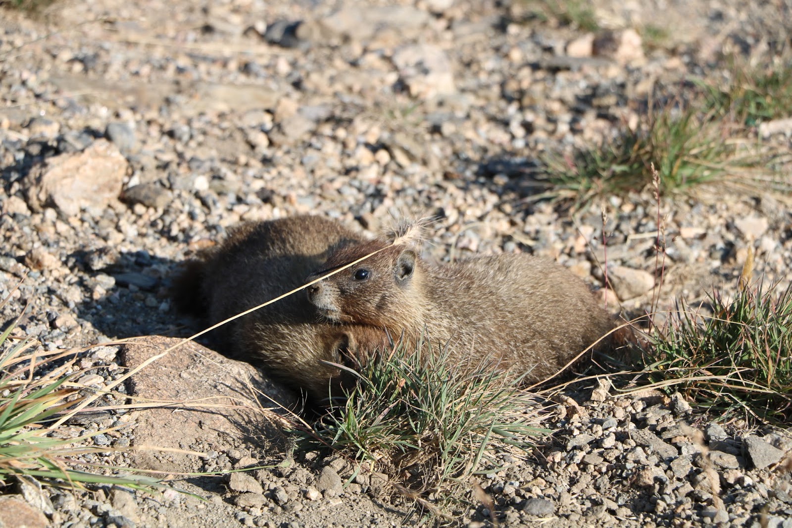
Soon after our waapiti encounter we saw a few western marmots. We have the eastern marmot in Virginia of course, which we refer to as a groundhog, or the whistle pig, a name I much prefer. That sure evokes a particular image does it not?

Onward and now upward we drive on road #34 to Lulu City, which is not in any measure a city but a place on the map where one encounters a series of tight switchbacks in the road that dictate a substantial rise in altitude to nine thousand feet where suddenly we find ourselves in a subalpine forest of fir and Engelman spruce. Lodgepole pines and huckleberries occur in previous burn areas. We see Clark's nutcrackers, Steller's jays and mountain chickadees.

At Eleven thousand feet just as suddenly we break out above the tree line and just like that we are on the roof of the park in alpine tundra where plant growth is limited because of cold and strong winds. We are treated to spectacular vistas, a grand landscape of precipitous voids, glaciers, cirque lakes and rock, rock, rock everywhere. The exposed backbone of the top of Rockies.


The Roof of the Park.


Eight hundred Foot Magma Wall


View From Above

Glaciated granite and other metamorphic rock with bastion-like walls of magma, speaking of ancient lava flows, now uplifted to these tremendous altitudes. Precipitation is high here and soils thin. Plant life is limited to dwarfed perennials and non-flowering lichens and mosses. Grasses and sedges are common where tundra soil is well-developed, which is not in many places. The name of the game is rock and snow. Well, not much snow this year, which has been exceptionally warm and dry. Damn that global warming. Plant communities here are a fragile. Footsteps can destroy tundra plants and it may take hundreds of years to recover.

We saw waapiti, big horn sheep and pikas.


Frolicking Pikas

The pika, sometimes called conies or rock rabbits, is a small mammal in fact related to rabbits and just happens to be one of the cutest animals on the planet. It is remarkable that this diminutive, six-inch long, cuddly-looking character lives in one of America’s harshest climates. And they are well adapted to it, with thick brown-gray peppered fur coats, sharp curved claws and padded toes to scamper around alpine rocks and excellent hearing and vision to keep them aware of danger. They live in rock faces, talus slopes, and cliffs near mountain meadows, in colonies often connected by burrow mazes underneath these rocky areas. Pikas do not hibernate, so they farm for a living, gathering large quantities of plants in their mouths and scurrying back to designated storage areas called "haystacks" to let the plants dry. When winter arrives, pikas bring all of their haystacks into their dens and will remain in the burrows most of the winter.

Pika can survive the super harsh alpine tundra climate with long sub-zero winters, and attacks by eagles, hawks, ospreys, falcons, kestrels, vultures and badgers and marmots, but like many other animals and plants, the pika’s greatest challenge, according to scientists and park natural resource managers, will most likely be climate change. Pikas cannot tolerate high temperatures for more than a few hours. As the climate warm, higher average temperatures in alpine tundra regions will force pikas higher up the mountains. You can only go so high before you run out of mountain. Lucky for us that we have a science denying, national monument destroying, non-reading, cheeseburger eating, pussy grabbing, golf playing, fake news promoting, self-possessed, profanity spouting, rabble rousing, bankrupting, colluding, justice obstructing orange haired big nuclear button, super smart genius in the Whitehouse these days to protect the poor pikas from global warming.

Let me be clear, which is what we do in our society when we are not ‘doubling down’ or ‘conflating’ or ‘pivoting’ or listening to ‘breaking news’ or ‘ground-breaking’, or ‘edge cutting’, or ‘being authentic’, or ‘circling back’, or ‘drilling down’ or ‘un-packing’, or ‘game-changing’ or ‘thinking out of the box’, or ‘going forward’, I most certainly lifted lots of information about these animals for this blog entry from Wikipedia.

Ever onward we travel 34, crossing the continental divide at Milner Pass (10,758 feet), passing Specimen Mountain (12,489 feet) to Medicine Bow Curve where we ascend to the highest point on the road at 12,183 feet, past Lava Cliffs, Iceberg Pass and the Rock Cut with the headwaters of the Big Thompson River to the south below us crashing through Forest Canyon and the summit of Sundance Mountain (12,466 feet) just to the north. At Rainbow Curve we start a long descent with harrowing switchbacks, passing Hidden Valley, Beaver Ponds, West Horse Shoe Park, Sheep Lakes and finally pull into the Aspenglen Camp Ground in the park, our refuge for the night. Same deal. Chirpy, cheerful rangers, clean facilities, campsites with water, firepits, bear boxes. What else could a cheap, crusty curmudgeon camper want.


Alpine Tundra at Twelve Thousand Feet

In the evening we rode out to Sheep Lake for some potential wildlife viewing. We got our chairs and spotting scope all set up and, seemingly on cue, were treated to a front row seat visit to the lake by a marvelous mother moose and her calf, a splendid pair indeed. They plunged into the lake’s icy waters and, after checking us out briefly to ascertain that we were not were packing heat, begin feeding on artisan, organic, natural-sun-raised, preservative-antibiotic-gluten free Rocky Mountain National Park gourmet submerged aquatic salad, garnished with all manner of stonefly, mayfly, caddisfly, dragonfly larvae, water fleas, fairy shrimps, tadpole shrimps and ostracods to add a slightly but ever so delicate gritty and peppery taste. 

Moose are the largest members of the deer family. Your average sized female moose weighs somewhere on the order of six to eight hundred pounds. Lots of that is thick, sinewy, powerful muscle they use to carry themselves along gracefully, and quickly if need be, in water and on land. And who couldn’t love that vacuum cleaner muzzle? The males go eight to thirteen hundred pounds and have antlers that can grow to six feet from tip to tip. Guess that pretty much squashes any argument that vegetarianism leads to ninety-pound weakling status.

After eating their fill these wondrous animals emerged from the lake, shook off gallons of water, took a bow, performed a little romping about encore, took another bow and trotted off to other moose adventures.

All in all, a pretty good start to our visit to Rocky Mountain National Park.


Momma Moose and Baby Moose Having Dinner

Back to Asplenglen for the night for us, to debate whether we should follow protocol and put our food in the bear box. Emily is for it. I'm for attracting bears. She won that one.

Sleep tight all you moose heads out there.

More Scenes from Today


Rocky Mountain Backbone


A Cirque Lake One Thousand Feet Below


Rock, Rock, Rock

Thursday

Day #71, August 28


Up and away after coffee and watching foraging rabbits to visit the Dinosaur Quarry Exhibit, a remarkable work indeed. Many of the Monument’s dinosaur fossils came out of an area extensively studied by Earl Douglass, Carnegie Museum of Natural History staff member in Pittsburgh, Pennsylvania. In 1908, Mr. Douglas started looking for dinosaur fossils in the Uinta Basin. After some disappointments, he found the quarry that became Dinosaur National Monument. He continued to excavate it for the Carnegie until he died in 1931, but his legacy lives on with the monument. The dinosaur quarry exhibit was one of the many innovative ideas he had about educating the public about the life and times of these creatures. A massive building constructed over a portion of the quarry wall, showing a conflagration of dinosaur bones washed up together and shown in the wall exactly as Douglas had found them. One can stroll along a cat walk, touch the fossils and wonder at the lives these phenomenal animals lived.
Away we go back to route #40 and a long drive eastward across the Colorado Plateau at six thousand feet rising toward Rocky Mountain National Park. Many horses, cattle and domesticated bison. Through hot dry country into Jensen, Dinosaur and Maybell where we crossed the Yampa River, through tiny ghostly hamlets and Craig, Hyden, Steamboat Springs and Kremmling, where we crossed the Colorado River, then through Hot Sulfur Springs and Grandy, ever rising toward the great Rocky Mountains. Camped at Timber Creek on the west side of the park. Tomorrow we cross the spine of the Rockies.


Day #70, August 27, Dinosaur National Monument


Traveled south on #191 east of the Flaming Gorge through more spectacular high, dry, hot country. Passed into Utah and finally to Dutch John (population 145) then crossed over the five-hundred-foot-high, Flaming Gorge Dam, that creates the ninety-one-mile-long Flaming Gorge Reservoir. Information from Wikipedia. The dam is 1,285 feet (392 m) long, and its reservoir has a capacity about twice the annual flow of the upper Green River. Operated to provide long-term storage for downstream water-rights commitments, the dam is also a major hydroelectric power source and is the main flood-control facility for the Green River system.

According to Wikipedia, the dam and reservoir have fragmented the upper Green River, blocking fish migration and significantly impacting many native species. Water released from the dam is generally cold and clear, as compared to the river's natural warm, silty flow, further changing the local riverine ecology. However, the cold water from Flaming Gorge has transformed about twenty-eight miles of the Green into a valued trout fishery.
Flaming Gorge Reservoir, Just behind the Dam 
High Above Flaming Gorge Reservoir

Retired Flaming Gorge Dam Turbine Wheel 
We crossed the dam and headed south into the Ashley National Forest and the Uinta Mountains, America’s only east – west trending mountain range with peaks ranging from 11,000 to 13,528 feet. Thousands of acres of juniper, pinyon pine forest. Passed a big mining operation north of Vernal, Utah (population 11,000). Simplot Vernal Mine
Dinosaur Country. Vernal’s economy is largely based on oil, natural gas, phosphate and uintaite or Gilsonite, a form of asphalt. However, these days, there are plenty of thirty-foot-tall, plastic dinosaurs deployed throughout the town to encourage tourism. I wish I could bring one home.

From Vernal we headed east on #40 to Jensen (population 412 and ten plastic dinosaurs) then north on #149 and into the Dinosaur National Monument, a dazzling landscape and one of those places to which we will return. A place where there is ample fossil evidence that dinosaurs roamed one hundred million years ago. We were greeted by the usual chipper and friendly Park Service Ranger at the entrance station then drove ten miles to our fabulous camp site right on the banks of the Green River or as I prefer, the Sisk-a-dee-agie, complete with our own private sandy beach. After setting up camp we sat by the river waiting and watching. In short order thirteen wild turkeys, looking rather dinosaur like, walked out of a willow thicket on the opposite side, took a long drink of cool Green River water and began foraging the banks for insects. A stately great blue heron joins his turkey cousins for a while. After a while they walked back into the willow grove as we sat in stunned silence. Time for a swim. In I went. Burr cold!
We unhitched Flicka II and took a sunset car tour through more breath-taking country, highlighted by Split Mountain, which we to learn more about the next day. We drove deeper into Monument Land and followed the map, passed a few other travelers and came to the still standing, homestead cabin of one Josie Bennet Morris, a remarkable woman who was married five times and divorced four times in an era when divorce was unheard of. The kiosk didn’t say what happened to the last guy.

“With no money to buy property, Josie decided in 1913 to homestead in Cub Creek. Here she built her own cabin and lived there alone for over fifty years. She shared her home with her son Crawford and his wife for a time; grandchildren spent summers working and playing alongside Josie.

Raised on the frontier, Josie lived into the modern era of electronics. For friends and acquaintances in the 1950s, Josie was a link to a world past. During Prohibition in the 1920s and into the 1930s, Josie brewed apricot brandy and chokecherry wine. After a lifetime of dressing in skirts, she switched to wearing pants in her later years. She was tried and acquitted twice for cattle rustling when she was in her 60s. At the age of 71, in an ambitious move to revive a profitable cattle business, she deeded her land away and lost all but the five acres where her cabin still stands. In December of 1963 the legendary Josie suffered a broken hip while in her cabin; she died of complications in May of 1964.”
Josie Morris Homestead

Josie's Dinning Room

On the way into Josie’s homestead we encountered petroglyphs of the Fremont people who lived in this area about a thousand years ago and left evidence of their presence in the form of petroglyphs and pictographs. Petroglyphs are carved or chipped into rock, a process which must have taken a very long time. These folks didn’t have power tools. We saw many examples. It’s quite something to reach out and touch these remarkable works of art and ponder the mystery of why they were created and to think about the daily lives of the Fremont people, living in a place with such extremes of seasonal weather. See the petroglyphs below.


Back to our campsite for the night, but not before another sitting session at out private beach where we were delighted to watch two enormous beaver appearing to forage their way down through shallow water on the opposite side of the river. I thought beaver ate tree bark, but these guys were gathering something from rocks in the river. I speculated that it might have been mussels. Oh, wait a minute, those aren’t beaver. They are river otter! Big fat North American River Otter (Lontra canadensis), fattened I hope on the native mussels found in the waters of the Green River basin, not the quazza and zebra mussels infesting many waters in the east and being found more and more often in certain western waters. The Bureau of Reclamation and other state and federal agencies are serious about stopping the spread of these non-native species. Mandatory inspection points are set up throughout the west. Anyone towing any kind of aquatic vessel must stop and be examined.
Our Private Beach Camp Site on the Green River


After an evening cocktail and supper, its beddy bye time for us. More Dinosaur Monument adventures tomorrow.  

Sweet dreams.