Tuesday

Day #80. September 6, On to Canyonlands National Park

Leaving Hovenweep and Canyons of the Ancients National Monuments. Much to see in these wonderful places. Seems like everywhere we go a parting comment is, “Wow, we need to come back here!”.


Off we go, westward bound on Hovenweep Road (route #213), to intersect with Cajon Mesa Road (BIA 2416), across bone dry Montezuma Creek to intersect with Hatch Trading Post Road, back into the Navajo Indian Reservation, intersect with route #191 and north through the Ute Mountain Indian Reservation. I should note that today’s Indian reservations are generally not the original home places of given tribes. Most often they are simply the places that white folks didn’t care to settle or exploit at a given time. Places to herd natives together to contain them.
Hovenweep and Canyons of the Ancients

New Friends

Damn Dry Country

On we go through Blanding, UT, and further north to turn west on route #211 toward the park. Blanding, with about thirty-four hundred souls, is the largest town in San Juan County. Mormons settled here in the late 19th century.


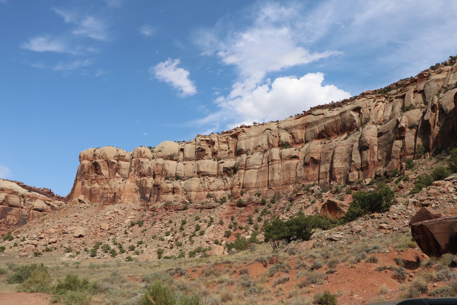
Route 211 takes us through a very scenic area of canyons, high, sandstone cliffs, mesas, broad, dry valleys and mostly dry river courses. 
On the Way to Newspaper Rock


We stop at Newspaper Rock, a Utah state monument featuring a two-hundred-foot-tall natural sandstone rock cliff carved with hundreds of petroglyphic figures, a mixture of human, animal, material and abstract forms, pictures of deer, buffalo, and pronghorn antelope. Petroglyphs, not to be confused with petrographs, are carvings, scratching or etchings in rock. Petrographs are drawings, paintings or inscriptions on rock. 

Newspaper Rock Petroglyph Samples


Anasazi, Fremont, Navajo, Anglo, and Pueblo people started making the carvings two thousand years ago. In Navajo, the rock is called "Tse' Hone'" which translates to a rock that tells a story, thus Newspaper Rock.


On to Canyonlands National Park, thirty miles distant. And what a park it is! We come in on the eastern side and take up residence at the Squaw Flat Campground, with a few other travelers, not too far distant from the confluence two mighty western rivers, the Green and the Colorado. Canyonlands is just one administrative unit in this southeastern Utah high desert country. Others are Arches National Park, the Glen Canyon National Recreation Area, Capital Reef National Park, Bears Ears National Monument and the Grand Staircase Escalante National Monument. Rugged, arid canyon country.
On the Road to Canyonlands


The Colorado River flows out of Canyonlands into Glen Canyon, originally a deep sandstone gorge, now filled with water and known as Lake Powell, one of the largest man-made reservoirs in the U.S.  Lake Powell exists because of the Glen Canyon Dam, a 710 foot high monstrosity near the town of Page, Arizona, built over a ten year period from 1956 to 1966 by the US Bureau of Reclamation.

Lake Powell is named for John Wesley Powell, a one-armed civil war veteran who led the first expedition to traverse the Colorado's Grand Canyon by boat. Ironic that the Lake bears his name because Powell, knew that water would be a limiting factor in western settlement. He knew first hand just how arid the west truly was.   He opposed development of large federal water projects, the creation of massive catchment basins miles and miles away from end users. That opposition cost him his career.


The US Bureau of Reclamation juggernaut, led by William Mulholland (think Mulholland Drive) and people like him, was determined to build immense, federally funded damn projects throughout the west. In fact, three months before Powell died in 1902, Congress launched a century of massive dam and canal construction costing billions of dollars.  The plan was to build the damns, catch the water, transport it by aqueduct and other means to agricultural and urban end users and charge for it. Turns out, the cost of building and maintaining the projects far outweighs revenues from water sales, which, you guessed it, the public subsidizes. Still happening today.   


Congress passed the Homestead Act in 1862 that encouraged settlement. Pro-development interests launched marketing strategies to get people moving westward. Newspaper editors, railroads, speculators and even water scientists, in a concerted effort encouraged by Bureau of Reclamation officials and government representatives, went so far as to tell poor eastern dirt farmers that if they simply got their butts out to the utopian west and plowed the land ample rains would follow. Farmers came by horse drawn wagon and train, plopped down their stuff, plowed the hard, dry land, took a long pull on the moonshine jug and waited for the rains to come, which they did not. Think Dust Bowl in the 1930s.


Predictably settlement did not follow any logical pattern as Powell would have wanted. He believed people should organize settlements around existing water sources, which would force them to conserve for certain lean times. He envisioned settlement in areas near reliable mountain snowmelt and stream, lake and river sources with short irrigation ditches leading to crops. Transporting water hundreds of miles did not make any sense to him.


Sorry to go on. I refer you to a brilliantly researched book on the subject. Cadillac Desert, the American West and Its Disappearing Water, by Marc Reisner. 


We settle in at the Squaw Flat Campground and go exploring in the 'Needles' section of the park.

Scenes from Cave Spring Trail - Leading to an Actual Spring. One of Just a Few in the Area. Cliff 'Hidey-Holes' Provided Shelter to Cowboys and Indians Alike. 


An Actual Springs


Canyonlands is a stunningly beautiful and majestic red rock landscape that the powerful Colorado and Green Rivers started to erode into countless canyons, mesas, and buttes over seventy million years ago. It is a most spectacular place.
Back to Squaw Flats for dinner and a restful night. 
More adventure tomorrow.

Monday

Day #79. September 5.


Up and away after a pleasant and restful night at the campground. We say goodbye to Ryan, who gave us his pancake mix because he was flying back the next day. It came in handy.

We stopped at the monument visitor center and walked along a loop trail to visit some of the more accessible ruins. Hot and dry usual. The trail ascended and descended rock ledges and followed along the edge of a canyon.

Ancient Structures in Hovenweep


President Warren G. Harding proclaimed Hovenweep a unit of the National Park System in 1923. The much larger Canyons of the Ancients National Monument, one hundred and seventy-six thousand acres of high desert country administered by the Bureau of Land Management (BLM) is in southwestern Colorado. Ecologically, historically and culturally Hovenweep and Canyons are the same. Barack Obama designated Canyons as a national monument early in his presidency. Good for him.

Smart, visionary American republican and democratic leaders have always worked to protect places of special natural and cultural value. What the hell is going in this administration?

The entire Four Corners area of Utah, Colorado, New Mexico and Arizona is home land to early native Americans. Relics and artifacts of the Anasazi people speak volumes about their ten-thousand-year occupancy. When one spends some time in this country and sees the on the ground evidence of their long term occupancy, it’s easy to conclude that this country belongs to them. We should not ignore a ten thousand year history.

Canyons contains the highest known archaeological site density in the United States. More than 6,355 recorded sites show rich, well preserved villages, field houses, check dams, reservoirs, great kivas, cliff dwellings, shrines, sacred springs, agricultural fields, petroglyphs and sweat lodges. Archaeologists estimate the total number of sites to be up to thirty thousand. Talk about walking through history!

We drive to Lowry Pueblo and visited more spectacular ruins.
Anasazi people constructed this pueblo (village) around 1060 AD. Forty to one hundred people lived there for about one hundred and sixty-five years. The structure has forty rooms and many surrounding kivas (ceremonial structures). The inhabitants farmed and hunted small game, made elaborately decorated pottery and probably ate lots of peyote and smoked a lot of dope. What else are you gonna do without cable news?

Lowry Pueblo Structures

This Rock Work has Stood the Test of Time


A Grand Kiva


Step Work into the Kiva


Archeologists Added The Roof Structure to Protect the Pueblo from Degradation


Back to the Anasazi Heritage Center to give it another go. At Sand Canyon Pueblo we saw six male mule deer. Went south on Route 491 back to Cortez. Picked up 160 south and drove past the Ute Mountain Indian Reservation to the north, then turned back to the northwest on 41/162, crossed over the Utah border into the Navajo Indian Reservation just to the southwest. Following the Jan Juan River, which is not much of a river in this country, we come to Aneth, which in the Navajo language means ‘just like the devil!' The Navajo used that phrase to describe the business practices of the community's first white trader. The name stuck. Capitalistic exploitation at its finest!

Aneth is a Navajo chapter headquarters, a unit of government on the reservation. There are oil fields nearby and the Aneth Field is still one of the major producing fields in the western U.S. Traditional Navajo hogans (ho'gone) or shade houses dot the spectacular, treeless landscape. About a thousand souls live around Aneth, mostly Navajo Indians. There is a community school, one gas station. No four-star restaurants or hotels. As of 2000, eighty-five percent of Aneth residents still speak the native Navajo language.

A Lone Cowboy


When You Come to a Fork in the Road, Take It.


Wild Mustangs on the Move

Local Dump Site

Roads in and out of Aneth are sparse, mostly gravel and dirt. They wash out in spring deluges and are hot and dusty most of the year. We turn northeast on Ismay Trading Post Road (2414) to begin our return to Colorado and the Hovenweep Campground. Driving along bone dry McElmo Creek we spot a lone cowboy on horseback with his dog enthusiastically following along. Further on we spot a herd of wild Mustangs racing across a field and the road ahead of us. Crossing back over into Colorado, we got ourselves good and lost. GPS works to locate a spot on the ground but sometimes it’s not so helpful when roads are not where ‘they are supposed to be’. After a 10-mile run on a gravel, dirt road we reach the end of the line and a local dumpsite. Had to backtrack for some distance to get back on the right road. Finally, after a long day we got back to our grand Hovenweep campsite.

Back at Hovenweep Campsite

In for the night.

Tomorrow, Canyonlands National Park.

Sunday

Day #78, September 4, 2017

Away we go this morning after visiting with the camp hosts, a nice Latino couple from Albuquerque. Onward and upward to Wolf Creek Pass. We straddle the Great Divide at 10,800 feet, within several hundred miles of the headwaters of the Rio Grande, Pecos, Arkansas, Canadian and Red rivers draining to the east and the San Juan, Green and Colorado rivers to the west.


Wolf Creek Pass, part of the San Juan mountain range, averages annual snowfall of four hundred inches, over thirty-eight feet of snow. Sounds like a lot of water, but in the spring, after torrents and torrents of runoff, this region dries off rapidly and by mid-summer and into fall the arid nature of the climate becomes apparent. Water becomes scarce.

Onward and westward to Pagosa Springs, Durango and finally Cortez where I had one of the best burritos ever at Gustavo’s Mexican Restaurant. From Cortez we visited the Anasazi Heritage Center in Delores, CO before we head into the Canyon of the Ancients National Monument. The Anasazi or Puebloan people inhabited this region for centuries and left ample evidence of their astonishing culture.


Don't You Just Hate People Who Do Foodie Pictures?

In the center, we met eighty-one-year young volunteer Nancy Lacell Becker.  Nancy came to this country from Asheville, North Carolina as a young woman and took up teaching theater in various venues including the Ute Mountain Indian Reservation. She got herself a husband and, after a few years, decided she liked Colorado better than the husband so sent him packing. After a couple of more husbands and many adventures she is still here and still teaching.

After a visit to this remarkable museum we head west to the remotely located Hovenweep National Monument located on the Cajon Mesa in the Great Sage Plain along the border between southeast Utah and southwest Colorado, just north and west of Cortez, an area of arid, high desert. Annual precipitation averages between five and fifteen inches depending primarily on elevation. Most of that comes in spring deluges. Spring, summer and fall elevated temperatures and low humidity promote rapid evaporation, so very little water is available to plants and animals. The canyons have some springs and seeps, which is where signs of human habitation mostly occur.

Puebloan Culture Items in the Anasazi Heritage Center


The name Hovenweep, in the Ute language means "deserted valley", apt as a description of the area's dry, desolate canyons and barren mesas as well as the ruins of ancient communities.

Ten thousand years ago nomadic native people visited this region to gather food and hunt. These people used the area for centuries, following the seasonal weather patterns. They built complex square and circular towers, cliff dwellings, kivas (ceremonial structures) and left petroglyphs like those in Mesa Verde National Park not far away. The masonry work is beautiful and skillfully done. Most of the ruins are off the beaten path and require a hike across dry, tortuous and hot terrain punctuated by sage brush scrubland and low growing pinyon-juniper forests.

Hovenweep Scenes


By the end of the thirteenth century, for unknown reasons ancestral Puebloans throughout this area migrated south to the Rio Grande Valley in New Mexico and the Little Colorado River Basin in Arizona. Probably looking for new sources of peyote and a Grateful Dead concert. Pueblo, Zuni and Hopi people are descendants of this culture.

Hovenweep is just one of several national monuments we visited. National monuments are real gems on the American landscape. Far less visited than national parks, in more remote and less roaded areas, but no less spectacular. The National Park Service manages some monuments, the Bureau of Land Management others. They all generally have excellent camping facilities, albeit in remote locations, which is fine by me. Not to get too political, the current administration of idiots under President Bone Spurs is doing what it can to reduce protection of some of these spectacular places.

We drove along a gravel road for ten miles to get to the only campsite in the monument. There were three other vehicles there. The campground was complete with shelter, fire pits, running water, showers and was situated on the edge of a canyon typical to the region. We took up residence there for the next two days.
After we settled in a young man camped nearby walked over to visit. “Hi there, I’m Ryan”, he said enthusiastically. “I couldn’t help but notice your Virginia tags. Where are you from?” I proceeded to explain, assured he would have no idea where Staunton Virginia was. Not necessary. “I’m from Nellysford over in Nelson County”, he said cheerfully. Nellysford is twenty miles from Staunton. Ryan went to Mary Washington College where our son Henry went. He knew Joe Moore who also attended Mary Washington. Joe is the son of Steve Moore my best buddy growing up. Ryan, known as Boomer to the athletic crowd at Mary Washington, is on vacation by himself. He had flown to Albuquerque, rented a truck, bought a modicum of camping gear and was doing what we were doing; having a ride-about. Small world all over again. What are the chances of running into a fellow Virginian, especially one hailing from so close to our hometown, in such a remote place?

Coyotes yipping in the distance. Evening libations, dinner, sunset, starry night.

Tomorrow we go exploring.

Thursday

Day #77, September 3

This morning we left Buffalo Creek on #285 southbound back to Trout Creek Pass and then to Salida on #291. We hailed a woman to ask where to get a good breakfast. Grace was her name and she was walking her dog Gracie. Turns out she is from Chesapeake, VA. Small world. A traumatic divorce and bad memories back east and here she is in Colorado for a fresh start.

On to Dawn’s CafĂ© for breakfast. Then south on #285 with the Sangre de Cristo Wilderness just to the east and the Rio Grande National Forest to the west. Through Villa Grove and Saguache where we went due south on #15 to Monte Vista then west on route # 160 to Del Norte and then South Fork where we crossed the Rio Grande River. Camped for the night in the Park Creek Camp Ground right on the South Fork of the Rio Grande in the Rio Grande National Forest. Lucky for us. The campground is closing for the season at noon tomorrow.

A Portion of the Sangre de Cristo Mountain Range to the West. Hot and Dry this Time of the Year.