Off we
go, westward bound on Hovenweep Road (route #213), to intersect with Cajon Mesa
Road (BIA 2416), across bone dry Montezuma Creek to intersect with Hatch
Trading Post Road, back into the Navajo Indian Reservation, intersect with
route #191 and north through the Ute Mountain Indian Reservation. I should note
that today’s Indian reservations are generally not the original home places of given tribes. Most often they are simply the places that white folks didn’t care to settle or exploit at a given time. Places to herd natives
together to contain them.
 |
Hovenweep and Canyons of the Ancients
|
 |
| New Friends |
 |
| Damn Dry Country |
On we
go through Blanding, UT, and further north to turn west on route #211 toward
the park. Blanding, with about thirty-four hundred souls, is the largest town
in San Juan County. Mormons settled here in
the late 19th century.
Route
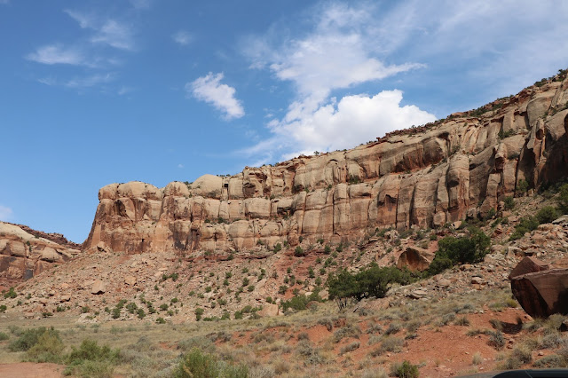
211 takes us through a very scenic area of canyons, high, sandstone cliffs,
mesas, broad, dry valleys and mostly dry river courses.
 |
| On the Way to Newspaper Rock |
We stop at Newspaper Rock,
a Utah state monument featuring a two-hundred-foot-tall natural sandstone rock cliff carved with hundreds of petroglyphic figures, a mixture of human, animal,
material and abstract forms, pictures of deer, buffalo, and pronghorn antelope.
Petroglyphs, not to be confused with petrographs, are carvings, scratching or
etchings in rock. Petrographs are drawings, paintings or inscriptions on rock.
Newspaper Rock Petroglyph Samples
Anasazi,
Fremont, Navajo, Anglo, and Pueblo people started making the carvings two
thousand years ago. In Navajo,
the rock is called "Tse' Hone'" which translates to a rock that tells
a story, thus Newspaper Rock.
On to
Canyonlands National Park, thirty miles distant. And what a park it is! We come
in on the eastern side and take up residence at the Squaw Flat Campground, with
a few other travelers, not too far distant from the confluence two mighty
western rivers, the Green and the Colorado. Canyonlands is just one
administrative unit in this southeastern Utah high desert country. Others are
Arches National Park, the Glen Canyon National Recreation Area, Capital Reef
National Park, Bears Ears National Monument and the Grand Staircase Escalante
National Monument. Rugged, arid canyon country.
On the Road to Canyonlands
The Colorado River flows out of
Canyonlands into Glen Canyon, originally a deep sandstone gorge, now filled with water and
known as Lake Powell, one of the largest man-made reservoirs in
the U.S. Lake Powell exists because of
the Glen Canyon Dam, a 710 foot high monstrosity near the town of Page,
Arizona, built over a ten year period from 1956 to 1966 by the US Bureau of
Reclamation.
Lake
Powell is named for John Wesley Powell, a one-armed civil war veteran
who led the first expedition to traverse the Colorado's Grand Canyon by
boat. Ironic that the Lake bears his name because Powell, knew that water would be a
limiting factor in western settlement. He knew first hand just how arid the
west truly was. He opposed development of large federal water projects, the creation of massive catchment basins miles and miles away from end users. That
opposition cost him his career.
The US
Bureau of Reclamation juggernaut, led by William Mulholland (think Mulholland
Drive) and people like him, was determined to build immense, federally funded
damn projects throughout the west. In fact, three months before Powell died in
1902, Congress launched a century of massive dam and canal construction costing
billions of dollars. The plan was to
build the damns, catch the water, transport it by aqueduct and other means to agricultural
and urban end users and charge for it. Turns out, the cost of building and
maintaining the projects far outweighs revenues from water sales, which, you
guessed it, the public subsidizes. Still happening today.
Congress passed the Homestead Act in 1862 that encouraged settlement. Pro-development
interests launched marketing strategies to get people moving westward. Newspaper
editors, railroads, speculators and even water scientists, in a concerted
effort encouraged by Bureau of Reclamation officials and government representatives,
went so far as to tell poor eastern dirt farmers that if they simply got their
butts out to the utopian west and plowed the land ample rains would follow. Farmers
came by horse drawn wagon and train, plopped down their stuff, plowed the hard,
dry land, took a long pull on the moonshine jug and waited for the rains to
come, which they did not. Think Dust Bowl in the 1930s.
Predictably
settlement did not follow any logical pattern as Powell would have wanted. He believed people should organize settlements around existing water sources,
which would force them to conserve for certain lean times. He envisioned settlement
in areas near reliable mountain snowmelt and stream, lake and river sources with
short irrigation ditches leading to crops. Transporting water hundreds of miles
did not make any sense to him.
Sorry
to go on. I refer you to a brilliantly researched book on the subject. Cadillac
Desert, the American West and Its Disappearing Water, by Marc Reisner.
We settle
in at the Squaw Flat Campground and go exploring in the 'Needles' section of the park.
Scenes from Cave Spring Trail - Leading to an Actual Spring. One of Just a Few in the Area. Cliff 'Hidey-Holes' Provided Shelter to Cowboys and Indians Alike.
 |
| An Actual Springs |
Canyonlands
is a stunningly beautiful and majestic red rock landscape that the powerful
Colorado and Green Rivers started to erode into countless canyons, mesas, and
buttes over seventy million years ago. It is a most spectacular place.
Back to Squaw Flats for dinner and a restful night.
More adventure tomorrow.


No comments:
Post a Comment