Up and away after a pleasant and restful night at the campground. We say goodbye to Ryan, who gave us his pancake mix because he was flying back the next day. It came in handy.
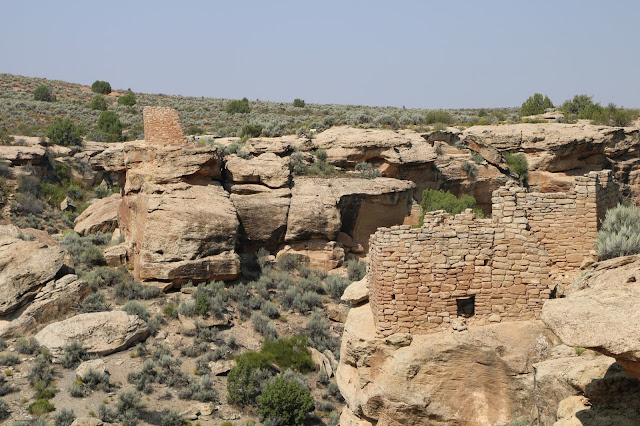
We stopped at the monument visitor center and walked along a loop trail to visit some of the more accessible ruins. Hot and dry usual. The trail ascended and descended rock ledges and followed along the edge of a canyon.
We stopped at the monument visitor center and walked along a loop trail to visit some of the more accessible ruins. Hot and dry usual. The trail ascended and descended rock ledges and followed along the edge of a canyon.
Ancient Structures in Hovenweep
President Warren G. Harding proclaimed Hovenweep a unit of the National Park System in 1923. The much larger Canyons of the Ancients National Monument, one hundred and seventy-six thousand acres of high desert country administered by the Bureau of Land Management (BLM) is in southwestern Colorado. Ecologically, historically and culturally Hovenweep and Canyons are the same. Barack Obama designated Canyons as a national monument early in his presidency. Good for him.
Smart, visionary American republican and democratic leaders have always worked to protect places of special natural and cultural value. What the hell is going in this administration?
The entire Four Corners area of Utah, Colorado, New Mexico and Arizona is home land to early native Americans. Relics and artifacts of the Anasazi people speak volumes about their ten-thousand-year occupancy. When one spends some time in this country and sees the on the ground evidence of their long term occupancy, it’s easy to conclude that this country belongs to them. We should not ignore a ten thousand year history.
Canyons contains the highest known archaeological site density in the United States. More than 6,355 recorded sites show rich, well preserved villages, field houses, check dams, reservoirs, great kivas, cliff dwellings, shrines, sacred springs, agricultural fields, petroglyphs and sweat lodges. Archaeologists estimate the total number of sites to be up to thirty thousand. Talk about walking through history!
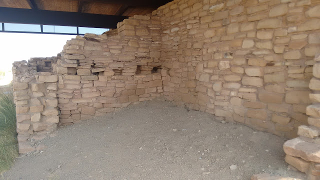
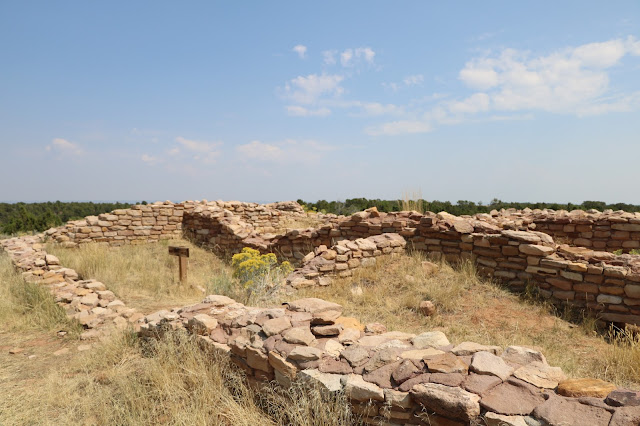
We drive to Lowry Pueblo and visited more spectacular ruins. Anasazi people constructed this pueblo (village) around 1060 AD. Forty to one hundred people lived there for about one hundred and sixty-five years. The structure has forty rooms and many surrounding kivas (ceremonial structures). The inhabitants farmed and hunted small game, made elaborately decorated pottery and probably ate lots of peyote and smoked a lot of dope. What else are you gonna do without cable news?
Lowry Pueblo Structures
 |
| This Rock Work has Stood the Test of Time |
 |
| A Grand Kiva |
 |
| Step Work into the Kiva |
 |
| Archeologists Added The Roof Structure to Protect the Pueblo from Degradation |
Back to the Anasazi Heritage Center to give it another go. At Sand Canyon Pueblo we saw six male mule deer. Went south on Route 491 back to Cortez. Picked up 160 south and drove past the Ute Mountain Indian Reservation to the north, then turned back to the northwest on 41/162, crossed over the Utah border into the Navajo Indian Reservation just to the southwest. Following the Jan Juan River, which is not much of a river in this country, we come to Aneth, which in the Navajo language means ‘just like the devil!' The Navajo used that phrase to describe the business practices of the community's first white trader. The name stuck. Capitalistic exploitation at its finest!
Aneth is a Navajo chapter headquarters, a unit of government on the reservation. There are oil fields nearby and the Aneth Field is still one of the major producing fields in the western U.S. Traditional Navajo hogans (ho'gone) or shade houses dot the spectacular, treeless landscape. About a thousand souls live around Aneth, mostly Navajo Indians. There is a community school, one gas station. No four-star restaurants or hotels. As of 2000, eighty-five percent of Aneth residents still speak the native Navajo language.
 |
| A Lone Cowboy |
 |
| When You Come to a Fork in the Road, Take It. |
 |
| Wild Mustangs on the Move |
 |
| Local Dump Site |
Roads in and out of Aneth are sparse, mostly gravel and dirt. They wash out in spring deluges and are hot and dusty most of the year. We turn northeast on Ismay Trading Post Road (2414) to begin our return to Colorado and the Hovenweep Campground. Driving along bone dry McElmo Creek we spot a lone cowboy on horseback with his dog enthusiastically following along. Further on we spot a herd of wild Mustangs racing across a field and the road ahead of us. Crossing back over into Colorado, we got ourselves good and lost. GPS works to locate a spot on the ground but sometimes it’s not so helpful when roads are not where ‘they are supposed to be’. After a 10-mile run on a gravel, dirt road we reach the end of the line and a local dumpsite. Had to backtrack for some distance to get back on the right road. Finally, after a long day we got back to our grand Hovenweep campsite.
 |
| Back at Hovenweep Campsite |
In for the night.
Tomorrow, Canyonlands National Park.


No comments:
Post a Comment