We see a black tailed jack rabbit shamelessly cavorting with
a cotton tail. An integrated rabbit community here in California.
After breakfast, we drive south on Black Canyon and Essex
Roads to leave the Preserve, bound for the Organ Pipe Cactus National Monument
in another famous western desert, the Sonoran. We take I40 east to Needles, CA on
the Colorado River (population 4,844), then 95 to Vidal Junction, CA, which consists
of a couple of gas stations, a trailer park, a closed diner and a billion
head of cattle in expansive, confined feed lots. We smell Vidal long before we get there.
Route 62E takes us to Parker, AZ (population 3000) and
through the Colorado River Indian Reservation and across the Colorado River. The reservation is home to Chemehuevi, Mohave, Hopi, and Navajo Native Americans.
We
pick up route 72 and pass through Bouse (population 1000), Utting (population
126) and Vicksburg (population 600). Then east on I10 to Buckeye, Arizona (population
63,000). Don’t ask me why I insist on reporting population numbers. It’s what I
do.
South from Buckeye on route 85 we pass through more captivating
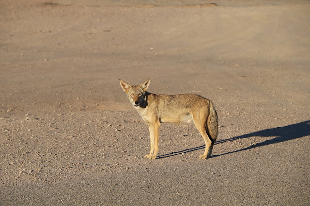
desert country to Gila Bend, AZ (population 1,900) where we watched Wile E Coyote cross the road. Further south we go to Ajo, AZ (population 3,500). Ajo
is home to the New Cornelia Copper Mine, a sprawling one-thousand-foot-deep,
mile and a half wide EPA superfund site. Superfund, as in bad news pollution. Although
there is no active mining at Cornelia it’s still open because, get this, current
owners say it’s too expensive to close, meaning clean up.
Onward we go toward Mexico and finally to Why, AZ
(population 116). Don’t ask me why they call Why Why. Nobody knows why town
folk call Why Why!
 |
| Wile E. Coyote Looking for a Handout. |
 |
| High Dollar Fountain |
At a Texaco station in Why, we watch, mesmerized, as two coyotes calmly walk into the parking lot and start asking the few store clients for a piece of pizza. An old ford truck sits at the station’s entrance with a fountain routed through it and a radio blaring out classic rock and roll alternating with stand-up comedy routines. Why not! Its Why, AZ.
Finally, we are in the heart of the Sonoran Desert, one-hundred-thousand square miles of hot, dry country stretching from southwestern Arizona, southeastern
California, across Baja California and the western half of Sonora, Mexico, with
a whole lot of nothing in between.
 |
| Organ Pipe Cactus (Stenocereus thurberi), a 'Signature' Plant in this Region |
The Mojave Desert lies to the north, in southern
Nevada, extreme southwestern Utah and south eastern California. So now we have
traveled in three major North American desert regions, the third being the
Great Basin Desert in the northern three-quarters of Nevada, western and southern
Utah, the southern third of Idaho and the southeastern corner of Oregon. There
are various systematic classifications of desert types throughout the western US
that note differences in flora, fauna, average rainfall and so on, but
fundamentally the entire region west of the 100th parallel is arid.
 |
| Desertscape. Dry for Sure |
To us traveling easterners lots of places we go out west
look wet and even lush, but that is mostly because water developers transport
water to those places from artificial impoundments via aqueduct and other
means. San Francisco, for example, gets about twenty inches of precipitation a
year and most of that between November and March. The rest of the year is bone
dry. When Spaniards first arrived in these parts not a single tree grew there.
Now the city sports a verdant urban tree scape all year, thanks to tunnels that
transport water from reservoirs near Yosemite National Park, a hundred miles
away.
 |
Our Very Fine Campsite in Organ Pipe Cactus National Monument
Free Insect Control Compliments of the National Park Service
|
 |
A majestic Saguaro Cactus, Ocotillo and Creosote Bush at Sunset in Our Campsite
Aho Mitakuye Oyasin, and good night.
|

No comments:
Post a Comment